You are here: Home > Network List > NE - New England Seismic Network Stations List
> Station EMMW Machias, ME, USA > Earthquake Result Viewer
EMMW Machias, ME, USA - Earthquake Result Viewer
*The percent match for this event was below the threshold and hence no stack was calculated.
| Earthquake location: |
Sea Of Okhotsk |
| Earthquake latitude/longitude: |
46.9/145.0 |
| Earthquake time(UTC): |
2018/07/01 (182) 20:45:42 GMT |
| Earthquake Depth: |
388 km |
| Earthquake Magnitude: |
5.6 Mww |
| Earthquake Catalog/Contributor: |
NEIC PDE/us |
|
| Network: |
NE New England Seismic Network |
| Station: |
EMMW Machias, ME, USA |
| Lat/Lon: |
44.71 N/67.46 W |
| Elevation: |
35 m |
|
| Distance: |
84.4 deg |
| Az: |
22.614 deg |
| Baz: |
338.311 deg |
| Ray Param: |
$rayparam |
*The percent match for this event was below the threshold and hence was not used in the summary stack. |
|
| Radial Match: |
47.082535 % |
| Radial Bump: |
400 |
| Transverse Match: |
68.335014 % |
| Transverse Bump: |
400 |
| SOD ConfigId: |
2752131 |
| Insert Time: |
2018-07-15 20:50:23.299 +0000 |
| GWidth: |
2.5 |
| Max Bumps: |
400 |
| Tol: |
0.001 |
|
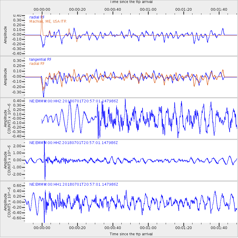
Signal To Noise
| Channel | StoN | STA | LTA |
| NE:EMMW:00:HHZ:20180701T20:57:01.147986Z | 4.936278 | 7.672177E-7 | 1.5542433E-7 |
| NE:EMMW:00:HH1:20180701T20:57:01.147986Z | 2.0200682 | 2.3138641E-7 | 1.1454386E-7 |
| NE:EMMW:00:HH2:20180701T20:57:01.147986Z | 1.1858116 | 1.951148E-7 | 1.6454113E-7 |
| Arrivals |
| Ps | |
| PpPs | |
| PsPs/PpSs | |


