You are here: Home > Network List > US - United States National Seismic Network Stations List
> Station MNTX Cornudas Mountains, Texas, USA > Earthquake Result Viewer
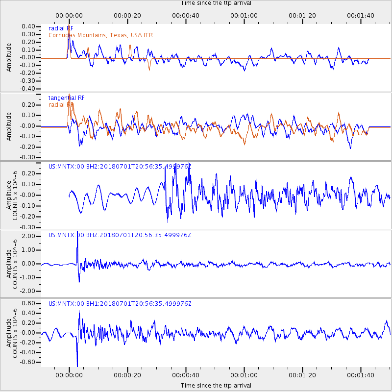
MNTX Cornudas Mountains, Texas, USA - Earthquake Result Viewer
*The percent match for this event was below the threshold and hence no stack was calculated.
| Earthquake location: |
Sea Of Okhotsk |
| Earthquake latitude/longitude: |
46.9/145.0 |
| Earthquake time(UTC): |
2018/07/01 (182) 20:45:42 GMT |
| Earthquake Depth: |
388 km |
| Earthquake Magnitude: |
5.6 Mww |
| Earthquake Catalog/Contributor: |
NEIC PDE/us |
|
| Network: |
US United States National Seismic Network |
| Station: |
MNTX Cornudas Mountains, Texas, USA |
| Lat/Lon: |
31.70 N/105.38 W |
| Elevation: |
404 m |
|
| Distance: |
79.4 deg |
| Az: |
54.781 deg |
| Baz: |
318.941 deg |
| Ray Param: |
$rayparam |
*The percent match for this event was below the threshold and hence was not used in the summary stack. |
|
| Radial Match: |
67.689896 % |
| Radial Bump: |
400 |
| Transverse Match: |
68.0523 % |
| Transverse Bump: |
400 |
| SOD ConfigId: |
2752131 |
| Insert Time: |
2018-07-15 20:54:21.628 +0000 |
| GWidth: |
2.5 |
| Max Bumps: |
400 |
| Tol: |
0.001 |
|
Signal To Noise
| Channel | StoN | STA | LTA |
| US:MNTX:00:BHZ:20180701T20:56:35.499976Z | 9.46416 | 5.703759E-7 | 6.0266935E-8 |
| US:MNTX:00:BH1:20180701T20:56:35.499976Z | 3.0856736 | 1.8462268E-7 | 5.983221E-8 |
| US:MNTX:00:BH2:20180701T20:56:35.499976Z | 1.9392142 | 1.1206327E-7 | 5.778798E-8 |
| Arrivals |
| Ps | |
| PpPs | |
| PsPs/PpSs | |


