You are here: Home > Network List > US - United States National Seismic Network Stations List
> Station WMOK Wichita Mountains, Oklahoma, USA > Earthquake Result Viewer
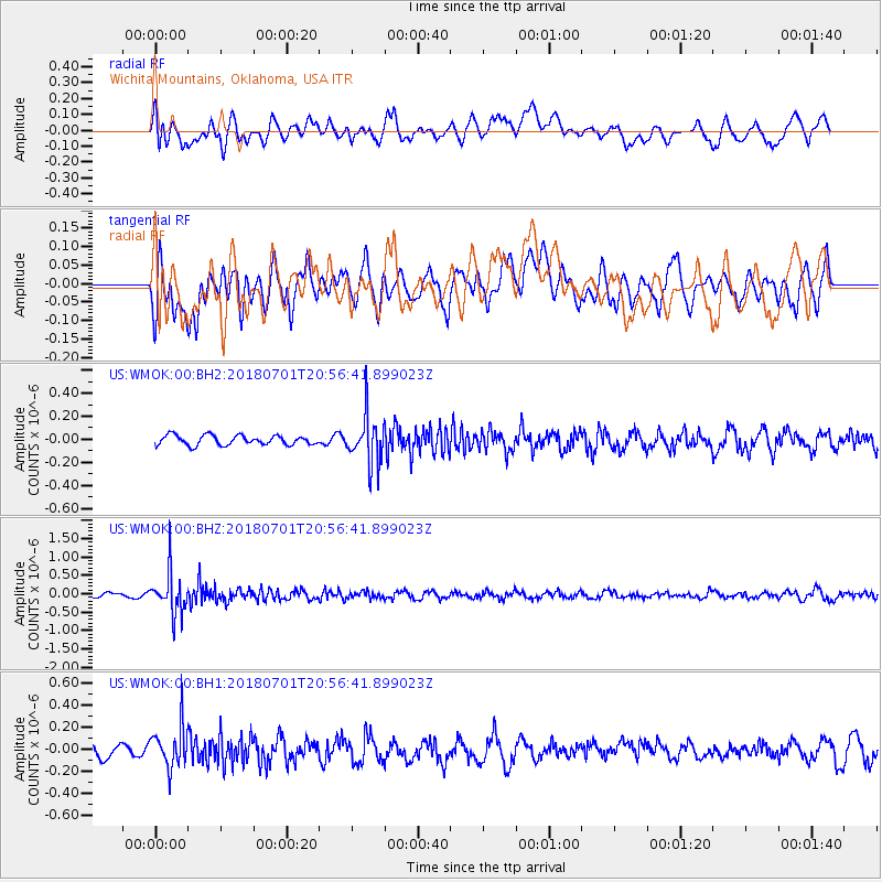
WMOK Wichita Mountains, Oklahoma, USA - Earthquake Result Viewer
*The percent match for this event was below the threshold and hence no stack was calculated.
| Earthquake location: |
Sea Of Okhotsk |
| Earthquake latitude/longitude: |
46.9/145.0 |
| Earthquake time(UTC): |
2018/07/01 (182) 20:45:42 GMT |
| Earthquake Depth: |
388 km |
| Earthquake Magnitude: |
5.6 Mww |
| Earthquake Catalog/Contributor: |
NEIC PDE/us |
|
| Network: |
US United States National Seismic Network |
| Station: |
WMOK Wichita Mountains, Oklahoma, USA |
| Lat/Lon: |
34.74 N/98.78 W |
| Elevation: |
486 m |
|
| Distance: |
80.6 deg |
| Az: |
48.496 deg |
| Baz: |
321.448 deg |
| Ray Param: |
$rayparam |
*The percent match for this event was below the threshold and hence was not used in the summary stack. |
|
| Radial Match: |
41.966923 % |
| Radial Bump: |
400 |
| Transverse Match: |
54.863613 % |
| Transverse Bump: |
400 |
| SOD ConfigId: |
2752131 |
| Insert Time: |
2018-07-15 20:54:46.920 +0000 |
| GWidth: |
2.5 |
| Max Bumps: |
400 |
| Tol: |
0.001 |
|
Signal To Noise
| Channel | StoN | STA | LTA |
| US:WMOK:00:BHZ:20180701T20:56:41.899023Z | 9.484093 | 5.7347086E-7 | 6.0466604E-8 |
| US:WMOK:00:BH1:20180701T20:56:41.899023Z | 1.9226869 | 1.9526722E-7 | 1.0155955E-7 |
| US:WMOK:00:BH2:20180701T20:56:41.899023Z | 5.120679 | 2.1465338E-7 | 4.191893E-8 |
| Arrivals |
| Ps | |
| PpPs | |
| PsPs/PpSs | |


