You are here: Home > Network List > US - United States National Seismic Network Stations List
> Station WMOK Wichita Mountains, Oklahoma, USA > Earthquake Result Viewer
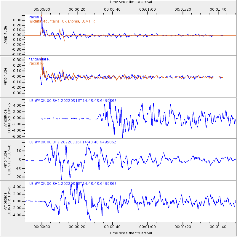
WMOK Wichita Mountains, Oklahoma, USA - Earthquake Result Viewer
*The percent match for this event was below the threshold and hence no stack was calculated.
| Earthquake location: |
Near East Coast Of Honshu, Japan |
| Earthquake latitude/longitude: |
37.7/141.6 |
| Earthquake time(UTC): |
2022/03/16 (075) 14:36:33 GMT |
| Earthquake Depth: |
63 km |
| Earthquake Magnitude: |
7.3 mww |
| Earthquake Catalog/Contributor: |
NEIC PDE/us |
|
| Network: |
US United States National Seismic Network |
| Station: |
WMOK Wichita Mountains, Oklahoma, USA |
| Lat/Lon: |
34.74 N/98.78 W |
| Elevation: |
486 m |
|
| Distance: |
88.7 deg |
| Az: |
45.728 deg |
| Baz: |
316.399 deg |
| Ray Param: |
$rayparam |
*The percent match for this event was below the threshold and hence was not used in the summary stack. |
|
| Radial Match: |
98.57583 % |
| Radial Bump: |
400 |
| Transverse Match: |
96.10469 % |
| Transverse Bump: |
400 |
| SOD ConfigId: |
27527651 |
| Insert Time: |
2022-03-30 15:54:06.549 +0000 |
| GWidth: |
2.5 |
| Max Bumps: |
400 |
| Tol: |
0.001 |
|
Signal To Noise
| Channel | StoN | STA | LTA |
| US:WMOK:00:BHZ:20220316T14:48:48.649986Z | 12.69213 | 2.8836735E-6 | 2.272017E-7 |
| US:WMOK:00:BH1:20220316T14:48:48.649986Z | 4.874978 | 6.4942543E-7 | 1.3321606E-7 |
| US:WMOK:00:BH2:20220316T14:48:48.649986Z | 5.5486298 | 6.2035497E-7 | 1.1180328E-7 |
| Arrivals |
| Ps | |
| PpPs | |
| PsPs/PpSs | |


