You are here: Home > Network List > CN - Canadian National Seismograph Network Stations List
> Station INK INUVIK, NT > Earthquake Result Viewer
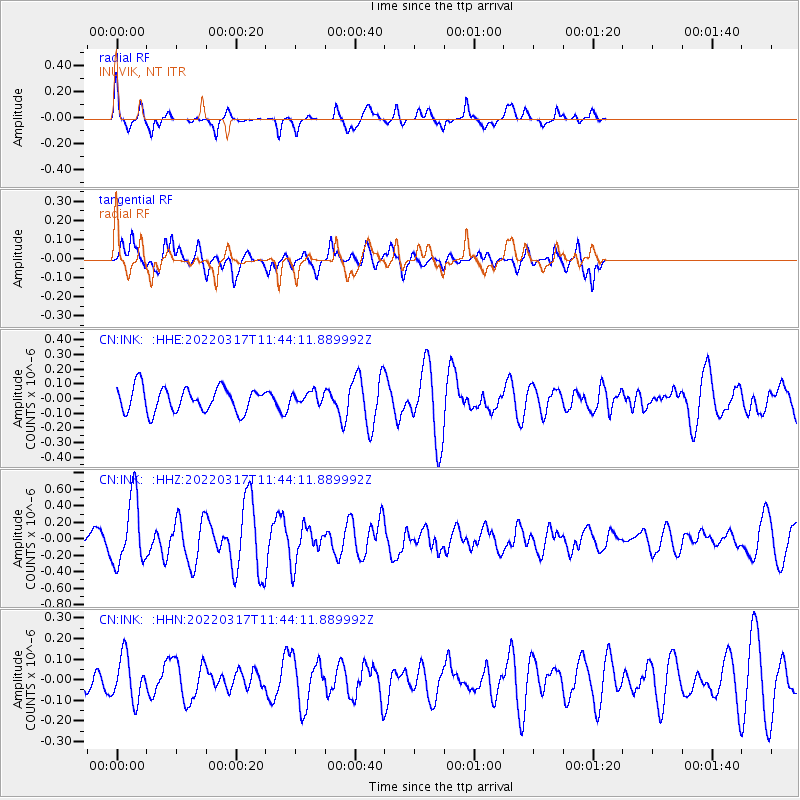
INK INUVIK, NT - Earthquake Result Viewer
*The percent match for this event was below the threshold and hence no stack was calculated.
| Earthquake location: |
Ryukyu Islands, Japan |
| Earthquake latitude/longitude: |
26.8/126.4 |
| Earthquake time(UTC): |
2022/03/17 (076) 11:33:37 GMT |
| Earthquake Depth: |
10 km |
| Earthquake Magnitude: |
5.6 mww |
| Earthquake Catalog/Contributor: |
NEIC PDE/us |
|
| Network: |
CN Canadian National Seismograph Network |
| Station: |
INK INUVIK, NT |
| Lat/Lon: |
68.31 N/133.53 W |
| Elevation: |
44 m |
|
| Distance: |
69.0 deg |
| Az: |
23.083 deg |
| Baz: |
289.538 deg |
| Ray Param: |
$rayparam |
*The percent match for this event was below the threshold and hence was not used in the summary stack. |
|
| Radial Match: |
65.37868 % |
| Radial Bump: |
297 |
| Transverse Match: |
62.412724 % |
| Transverse Bump: |
374 |
| SOD ConfigId: |
27527651 |
| Insert Time: |
2022-03-31 11:44:11.550 +0000 |
| GWidth: |
2.5 |
| Max Bumps: |
400 |
| Tol: |
0.001 |
|
Signal To Noise
| Channel | StoN | STA | LTA |
| CN:INK: :HHZ:20220317T11:44:11.889992Z | 3.7555416 | 4.0859103E-7 | 1.0879684E-7 |
| CN:INK: :HHN:20220317T11:44:11.889992Z | 1.2080264 | 1.0688363E-7 | 8.847789E-8 |
| CN:INK: :HHE:20220317T11:44:11.889992Z | 0.49075142 | 4.064392E-8 | 8.281977E-8 |
| Arrivals |
| Ps | |
| PpPs | |
| PsPs/PpSs | |


