AZ48 Arizona48 - Earthquake Result Viewer
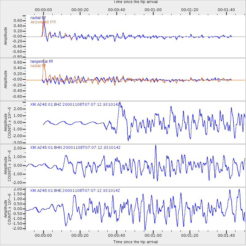
Earthquake location: Panama-Colombia Border Region
Earthquake latitude/longitude: 7.0/-77.8
Earthquake time(UTC): 2000/11/08 (313) 06:59:58 GMT
Earthquake Depth: 17 km
Earthquake Magnitude: 6.0 MB, 6.4 MS, 6.5 MW, 6.2 ML
Earthquake Catalog/Contributor: WHDF/NEIC
Network: XM Rio Grande Seismic Transect
Station: AZ48 Arizona48
Lat/Lon: 36.76 N/109.54 W
Elevation: 1664 m
Distance: 41.4 deg
Az: 320.29 deg
Baz: 127.846 deg
Ray Param: 0.07382741
Estimated Moho Depth: 57.5 km
Estimated Crust Vp/Vs: 1.96
Assumed Crust Vp: 6.476 km/s
Estimated Crust Vs: 3.308 km/s
Estimated Crust Poisson's Ratio: 0.32
Radial Match: 88.008675 %
Radial Bump: 400
Transverse Match: 63.6426 %
Transverse Bump: 400
SOD ConfigId: 16820
Insert Time: 2010-02-26 17:18:41.601 +0000
GWidth: 2.5
Max Bumps: 400
Tol: 0.001

Signal To Noise

ChannelStoNSTALTA
XM:AZ48:01:BHN:20001108T07:07:12.931014Z1.24305342.0835206E-71.6761311E-7
XM:AZ48:01:BHE:20001108T07:07:12.931014Z1.41767452.474737E-71.7456313E-7
XM:AZ48:01:BHZ:20001108T07:07:12.931014Z2.107813.629077E-71.7217288E-7
Arrivals
Ps9.1 SECOND
PpPs25 SECOND
PsPs/PpSs34 SECOND