You are here: Home > Network List > IW - Intermountain West Stations List
> Station PLID Pearl Lake, Idaho, USA > Earthquake Result Viewer
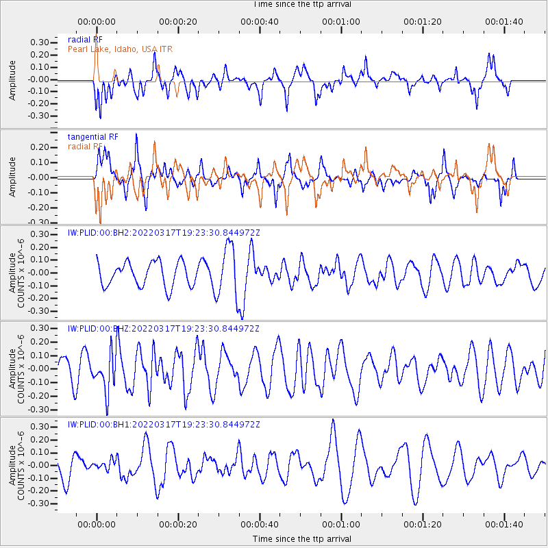
PLID Pearl Lake, Idaho, USA - Earthquake Result Viewer
*The percent match for this event was below the threshold and hence no stack was calculated.
| Earthquake location: |
South Of Tonga Islands |
| Earthquake latitude/longitude: |
-26.9/-175.9 |
| Earthquake time(UTC): |
2022/03/17 (076) 19:11:02 GMT |
| Earthquake Depth: |
10 km |
| Earthquake Magnitude: |
5.1 Mww |
| Earthquake Catalog/Contributor: |
NEIC PDE/us |
|
| Network: |
IW Intermountain West |
| Station: |
PLID Pearl Lake, Idaho, USA |
| Lat/Lon: |
45.09 N/116.00 W |
| Elevation: |
2164 m |
|
| Distance: |
90.0 deg |
| Az: |
37.819 deg |
| Baz: |
230.621 deg |
| Ray Param: |
$rayparam |
*The percent match for this event was below the threshold and hence was not used in the summary stack. |
|
| Radial Match: |
55.27937 % |
| Radial Bump: |
400 |
| Transverse Match: |
61.27322 % |
| Transverse Bump: |
358 |
| SOD ConfigId: |
27527651 |
| Insert Time: |
2022-03-31 19:23:09.117 +0000 |
| GWidth: |
2.5 |
| Max Bumps: |
400 |
| Tol: |
0.001 |
|
Signal To Noise
| Channel | StoN | STA | LTA |
| IW:PLID:00:BHZ:20220317T19:23:30.844972Z | 1.217393 | 1.3866021E-7 | 1.138993E-7 |
| IW:PLID:00:BH1:20220317T19:23:30.844972Z | 0.33636835 | 4.0418556E-8 | 1.2016159E-7 |
| IW:PLID:00:BH2:20220317T19:23:30.844972Z | 2.246876 | 2.0885632E-7 | 9.295409E-8 |
| Arrivals |
| Ps | |
| PpPs | |
| PsPs/PpSs | |


