AZ48 Arizona48 - Earthquake Result Viewer
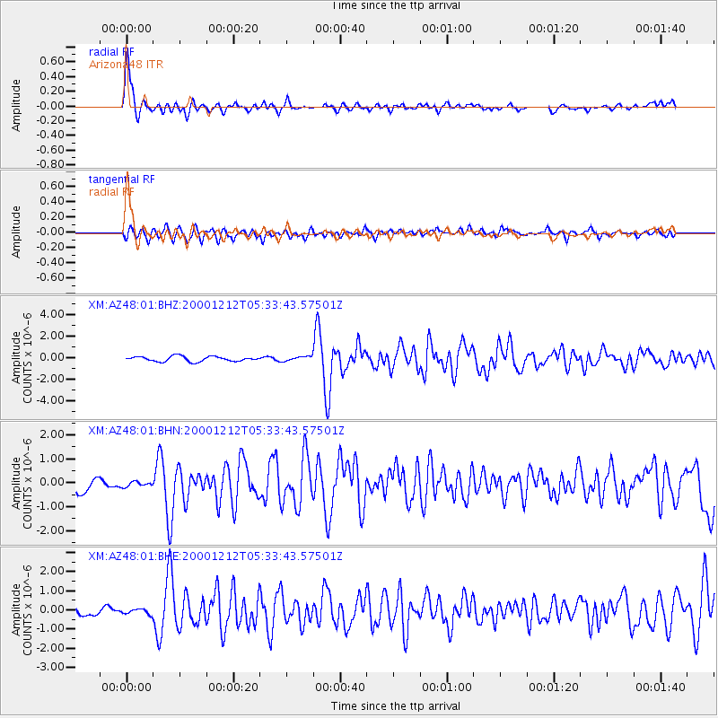
Earthquake location: South Of Panama
Earthquake latitude/longitude: 6.0/-82.7
Earthquake time(UTC): 2000/12/12 (347) 05:26:45 GMT
Earthquake Depth: 10 km
Earthquake Magnitude: 5.8 MB, 5.7 MS, 6.3 ME, 6.1 MW
Earthquake Catalog/Contributor: WHDF/NEIC
Network: XM Rio Grande Seismic Transect
Station: AZ48 Arizona48
Lat/Lon: 36.76 N/109.54 W
Elevation: 1664 m
Distance: 39.2 deg
Az: 324.994 deg
Baz: 134.728 deg
Ray Param: 0.07510157
Estimated Moho Depth: 33.75 km
Estimated Crust Vp/Vs: 1.60
Assumed Crust Vp: 6.476 km/s
Estimated Crust Vs: 4.047 km/s
Estimated Crust Poisson's Ratio: 0.18
Radial Match: 86.45986 %
Radial Bump: 400
Transverse Match: 66.85365 %
Transverse Bump: 400
SOD ConfigId: 27569
Insert Time: 2010-02-26 17:18:48.628 +0000
GWidth: 2.5
Max Bumps: 400
Tol: 0.001

Signal To Noise

ChannelStoNSTALTA
XM:AZ48:01:BHN:20001212T05:33:43.57501Z0.337949341.1368835E-73.364065E-7
XM:AZ48:01:BHE:20001212T05:33:43.57501Z0.57032831.4044193E-72.4624754E-7
XM:AZ48:01:BHZ:20001212T05:33:43.57501Z0.89366062.0519603E-72.2961294E-7
Arrivals
Ps3.4 SECOND
PpPs12 SECOND
PsPs/PpSs16 SECOND