You are here: Home > Network List > IW - Intermountain West Stations List
> Station MOOW Moose Ponds, Wyoming, USA > Earthquake Result Viewer
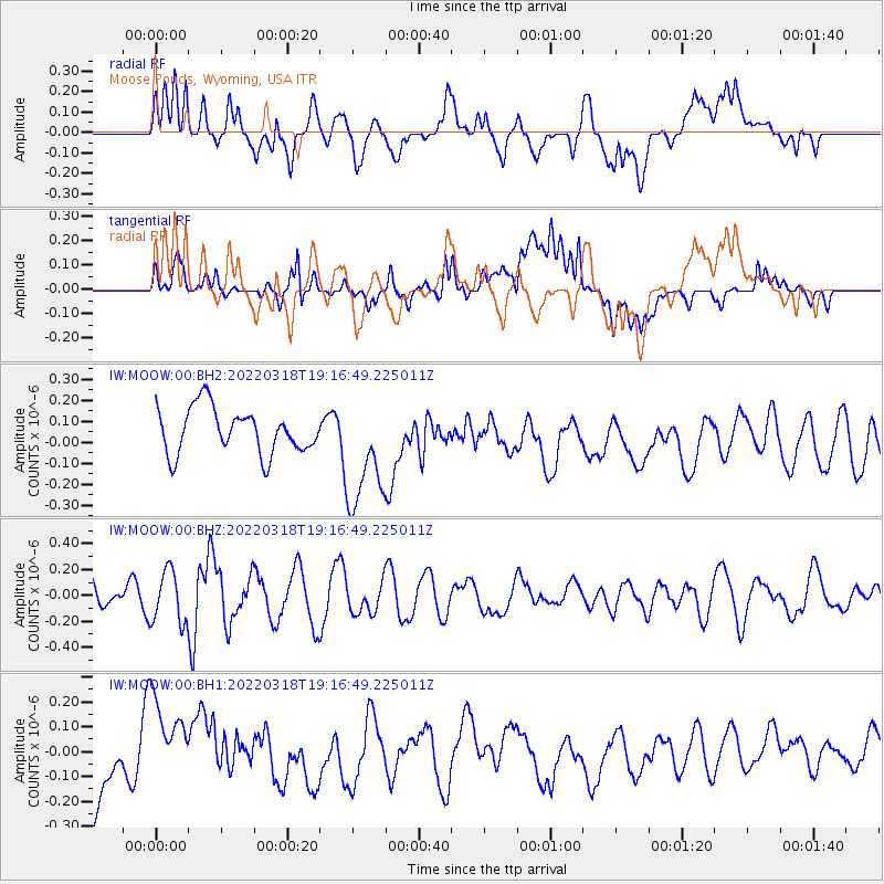
MOOW Moose Ponds, Wyoming, USA - Earthquake Result Viewer
*The percent match for this event was below the threshold and hence no stack was calculated.
| Earthquake location: |
Northeast Of Taiwan |
| Earthquake latitude/longitude: |
25.7/124.0 |
| Earthquake time(UTC): |
2022/03/18 (077) 19:04:18 GMT |
| Earthquake Depth: |
167 km |
| Earthquake Magnitude: |
5.9 mww |
| Earthquake Catalog/Contributor: |
NEIC PDE/us |
|
| Network: |
IW Intermountain West |
| Station: |
MOOW Moose Ponds, Wyoming, USA |
| Lat/Lon: |
43.75 N/110.74 W |
| Elevation: |
2128 m |
|
| Distance: |
94.6 deg |
| Az: |
36.42 deg |
| Baz: |
312.331 deg |
| Ray Param: |
$rayparam |
*The percent match for this event was below the threshold and hence was not used in the summary stack. |
|
| Radial Match: |
37.37741 % |
| Radial Bump: |
400 |
| Transverse Match: |
38.584194 % |
| Transverse Bump: |
400 |
| SOD ConfigId: |
27527651 |
| Insert Time: |
2022-04-01 19:18:07.888 +0000 |
| GWidth: |
2.5 |
| Max Bumps: |
400 |
| Tol: |
0.001 |
|
Signal To Noise
| Channel | StoN | STA | LTA |
| IW:MOOW:00:BHZ:20220318T19:16:49.225011Z | 1.7671272 | 2.0092399E-7 | 1.1370093E-7 |
| IW:MOOW:00:BH1:20220318T19:16:49.225011Z | 0.8179036 | 1.5721766E-7 | 1.9222028E-7 |
| IW:MOOW:00:BH2:20220318T19:16:49.225011Z | 2.5276299 | 2.719282E-7 | 1.07582295E-7 |
| Arrivals |
| Ps | |
| PpPs | |
| PsPs/PpSs | |


