
AZ48 Arizona48 - Earthquake Result Viewer
| ||||||||||||||||||
| ||||||||||||||||||
| ||||||||||||||||||
|
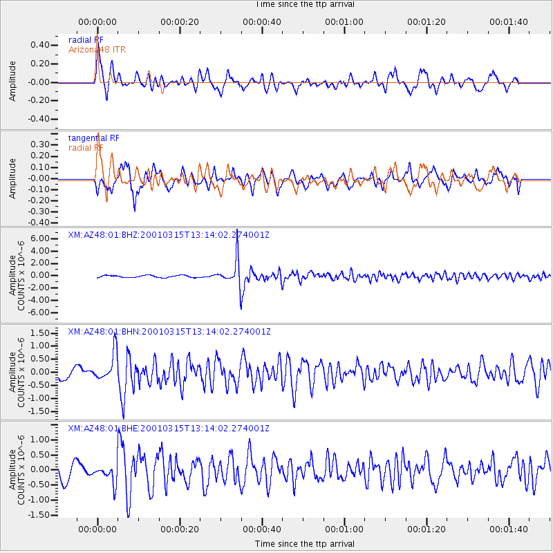
Signal To Noise
| Channel | StoN | STA | LTA |
| XM:AZ48:01:BHN:20010315T13:14:02.274001Z | 3.0086732 | 5.6961323E-7 | 1.8932374E-7 |
| XM:AZ48:01:BHE:20010315T13:14:02.274001Z | 1.1582074 | 3.2209863E-7 | 2.78101E-7 |
| XM:AZ48:01:BHZ:20010315T13:14:02.274001Z | 12.97105 | 2.172133E-6 | 1.6746007E-7 |
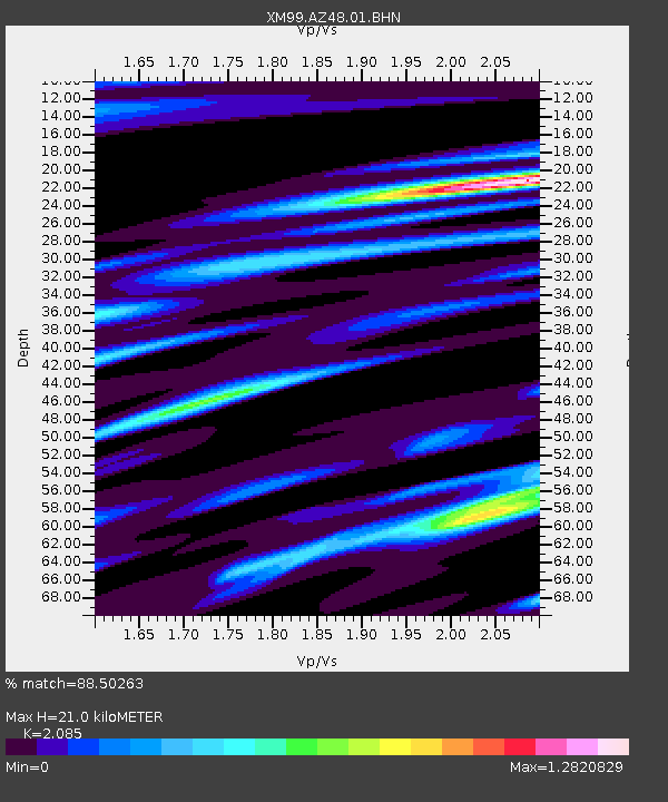
| Arrivals | |
| Ps | 3.6 SECOND |
| PpPs | 9.7 SECOND |
| PsPs/PpSs | 13 SECOND |

