You are here: Home > Network List > GS - US Geological Survey Networks Stations List
> Station KAN13 Rinehart Farm > Earthquake Result Viewer
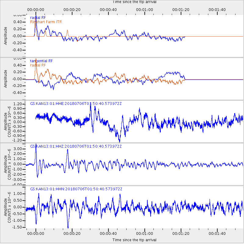
KAN13 Rinehart Farm - Earthquake Result Viewer
*The percent match for this event was below the threshold and hence no stack was calculated.
| Earthquake location: |
Near East Coast Of Kamchatka |
| Earthquake latitude/longitude: |
51.6/157.9 |
| Earthquake time(UTC): |
2018/07/06 (187) 01:40:08 GMT |
| Earthquake Depth: |
80 km |
| Earthquake Magnitude: |
6.1 Mwp |
| Earthquake Catalog/Contributor: |
NEIC PDE/us |
|
| Network: |
GS US Geological Survey Networks |
| Station: |
KAN13 Rinehart Farm |
| Lat/Lon: |
37.01 N/97.48 W |
| Elevation: |
340 m |
|
| Distance: |
70.0 deg |
| Az: |
55.499 deg |
| Baz: |
320.06 deg |
| Ray Param: |
$rayparam |
*The percent match for this event was below the threshold and hence was not used in the summary stack. |
|
| Radial Match: |
68.54303 % |
| Radial Bump: |
400 |
| Transverse Match: |
48.24123 % |
| Transverse Bump: |
400 |
| SOD ConfigId: |
2752131 |
| Insert Time: |
2018-07-20 01:49:04.722 +0000 |
| GWidth: |
2.5 |
| Max Bumps: |
400 |
| Tol: |
0.001 |
|
Signal To Noise
| Channel | StoN | STA | LTA |
| GS:KAN13:01:HHZ:20180706T01:50:40.573972Z | 11.491235 | 1.5237276E-6 | 1.3259913E-7 |
| GS:KAN13:01:HHN:20180706T01:50:40.573972Z | 3.1896281 | 5.305762E-7 | 1.6634421E-7 |
| GS:KAN13:01:HHE:20180706T01:50:40.573972Z | 2.4158628 | 4.7339614E-7 | 1.9595323E-7 |
| Arrivals |
| Ps | |
| PpPs | |
| PsPs/PpSs | |


