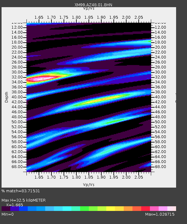
AZ48 Arizona48 - Earthquake Result Viewer

Earthquake location: South Of Panama
Earthquake latitude/longitude: 5.6/-82.6
Earthquake time(UTC): 1999/12/28 (362) 12:46:58 GMT
Earthquake Depth: 10 km
Earthquake Magnitude: 5.4 MB, 5.5 MS, 5.9 MW, 5.5 ML
Earthquake Catalog/Contributor: WHDF/NEIC
Network: XM Rio Grande Seismic Transect
Station: AZ48 Arizona48
Lat/Lon: 36.76 N/109.54 W
Elevation: 1664 m
Distance: 39.6 deg
Az: 325.245 deg
Baz: 135.048 deg
Ray Param: 0.07489928
Estimated Moho Depth: 32.5 km
Estimated Crust Vp/Vs: 1.66
Assumed Crust Vp: 6.476 km/s
Estimated Crust Vs: 3.889 km/s
Estimated Crust Poisson's Ratio: 0.22
Radial Match: 83.71531 %
Radial Bump: 381
Transverse Match: 72.75791 %
Transverse Bump: 400
SOD ConfigId: 27569
Insert Time: 2010-02-26 17:18:57.067 +0000
GWidth: 2.5
Max Bumps: 400
Tol: 0.001

Signal To Noise

ChannelStoNSTALTA
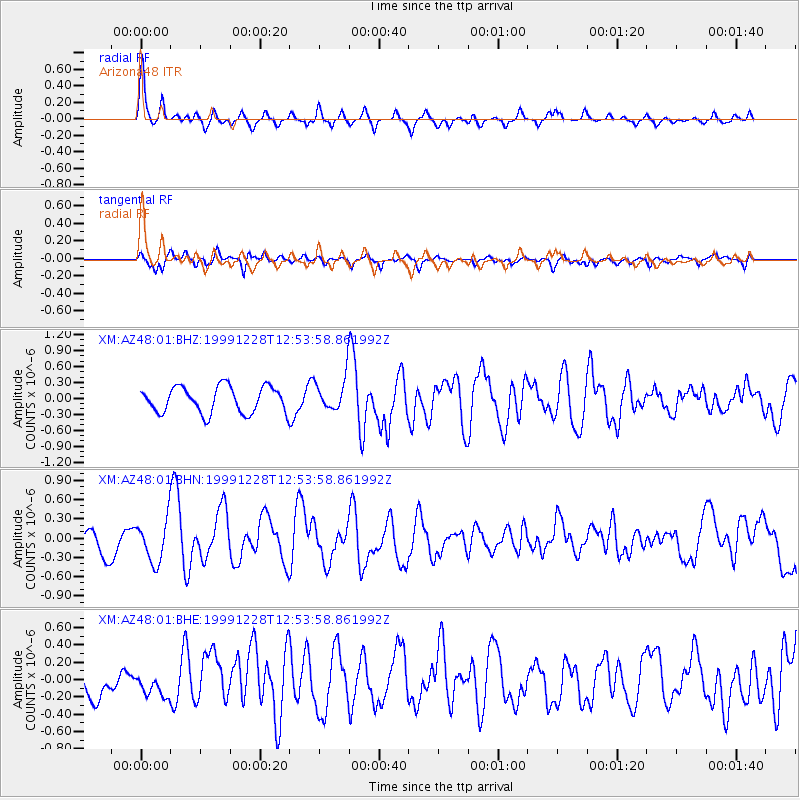
XM:AZ48:01:BHN:19991228T12:53:58.861992Z1.85383673.34708E-71.8054881E-7
XM:AZ48:01:BHE:19991228T12:53:58.861992Z0.55089861.3452743E-72.4419634E-7
XM:AZ48:01:BHZ:19991228T12:53:58.861992Z1.25538343.093278E-72.4640107E-7
Arrivals
Ps3.6 SECOND
PpPs12 SECOND
PsPs/PpSs16 SECOND