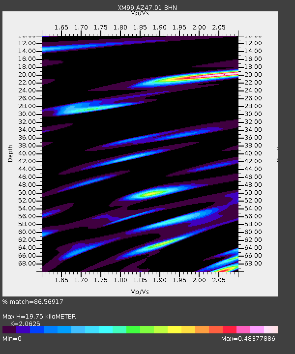
AZ47 Arizona47 - Earthquake Result Viewer
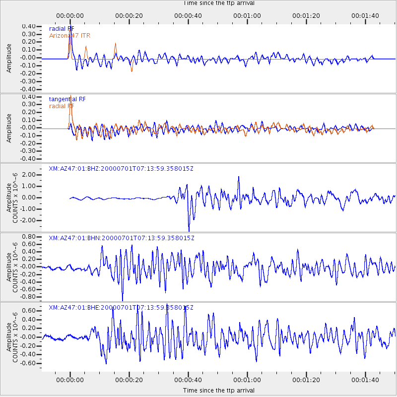
Earthquake location: Near S. Coast Of Honshu, Japan
Earthquake latitude/longitude: 34.2/139.1
Earthquake time(UTC): 2000/07/01 (183) 07:01:55 GMT
Earthquake Depth: 10 km
Earthquake Magnitude: 6.0 MB, 6.1 MS, 6.2 MW, 6.2 MW
Earthquake Catalog/Contributor: WHDF/NEIC
Network: XM Rio Grande Seismic Transect
Station: AZ47 Arizona47
Lat/Lon: 36.64 N/109.33 W
Elevation: 1752 m
Distance: 85.0 deg
Az: 48.687 deg
Baz: 309.306 deg
Ray Param: 0.04511165
Estimated Moho Depth: 19.75 km
Estimated Crust Vp/Vs: 2.06
Assumed Crust Vp: 6.476 km/s
Estimated Crust Vs: 3.14 km/s
Estimated Crust Poisson's Ratio: 0.35
Radial Match: 86.56917 %
Radial Bump: 400
Transverse Match: 83.83908 %
Transverse Bump: 400
SOD ConfigId: 27569
Insert Time: 2010-02-26 17:19:16.934 +0000
GWidth: 2.5
Max Bumps: 400
Tol: 0.001

Signal To Noise

ChannelStoNSTALTA
XM:AZ47:01:BHN:20000701T07:13:59.358015Z0.760362574.484543E-85.897901E-8
XM:AZ47:01:BHE:20000701T07:13:59.358015Z0.88084873.4997324E-83.973137E-8
XM:AZ47:01:BHZ:20000701T07:13:59.358015Z1.59792899.851551E-86.1651996E-8
Arrivals
Ps3.3 SECOND
PpPs9.1 SECOND
PsPs/PpSs12 SECOND