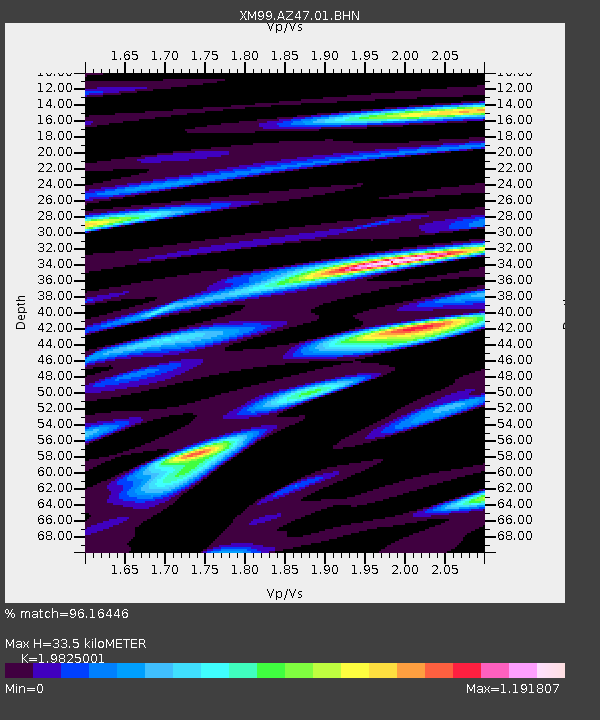
AZ47 Arizona47 - Earthquake Result Viewer

Earthquake location: Tonga Islands
Earthquake latitude/longitude: -17.2/-173.9
Earthquake time(UTC): 2000/09/26 (270) 06:17:52 GMT
Earthquake Depth: 56 km
Earthquake Magnitude: 6.1 MB, 6.1 MS, 6.4 MW, 6.1 ME
Earthquake Catalog/Contributor: WHDF/NEIC
Network: XM Rio Grande Seismic Transect
Station: AZ47 Arizona47
Lat/Lon: 36.64 N/109.33 W
Elevation: 1752 m
Distance: 81.1 deg
Az: 47.35 deg
Baz: 240.942 deg
Ray Param: 0.047750343
Estimated Moho Depth: 33.5 km
Estimated Crust Vp/Vs: 1.98
Assumed Crust Vp: 6.476 km/s
Estimated Crust Vs: 3.267 km/s
Estimated Crust Poisson's Ratio: 0.33
Radial Match: 96.16446 %
Radial Bump: 400
Transverse Match: 94.02412 %
Transverse Bump: 400
SOD ConfigId: 16820
Insert Time: 2010-02-26 17:19:23.198 +0000
GWidth: 2.5
Max Bumps: 400
Tol: 0.001

Signal To Noise

ChannelStoNSTALTA
XM:AZ47:01:BHN:20000926T06:29:30.331021Z3.95763092.7989654E-77.072325E-8
XM:AZ47:01:BHE:20000926T06:29:30.331021Z5.1148224.6960176E-79.181195E-8
XM:AZ47:01:BHZ:20000926T06:29:30.331021Z31.352639.320777E-72.9728852E-8
Arrivals
Ps5.2 SECOND
PpPs15 SECOND
PsPs/PpSs20 SECOND