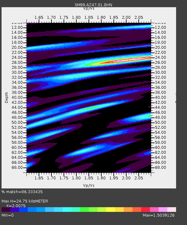
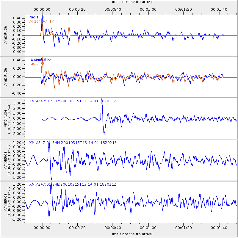
AZ47 Arizona47 - Earthquake Result Viewer

Earthquake location: Near Coast Of Central Chile
Earthquake latitude/longitude: -32.3/-71.5
Earthquake time(UTC): 2001/03/15 (074) 13:02:42 GMT
Earthquake Depth: 37 km
Earthquake Magnitude: 6.1 MB, 5.6 MS, 6.0 MW, 5.4 MD
Earthquake Catalog/Contributor: WHDF/NEIC
Network: XM Rio Grande Seismic Transect
Station: AZ47 Arizona47
Lat/Lon: 36.64 N/109.33 W
Elevation: 1752 m
Distance: 77.2 deg
Az: 329.599 deg
Baz: 147.814 deg
Ray Param: 0.05043276
Estimated Moho Depth: 24.75 km
Estimated Crust Vp/Vs: 2.01
Assumed Crust Vp: 6.476 km/s
Estimated Crust Vs: 3.226 km/s
Estimated Crust Poisson's Ratio: 0.33
Radial Match: 86.333435 %
Radial Bump: 400
Transverse Match: 70.22397 %
Transverse Bump: 400
SOD ConfigId: 4714
Insert Time: 2010-02-26 17:19:27.212 +0000
GWidth: 2.5
Max Bumps: 400
Tol: 0.001

Signal To Noise

ChannelStoNSTALTA
XM:AZ47:01:BHN:20010315T13:14:01.182021Z3.60342674.830807E-71.3406148E-7
XM:AZ47:01:BHE:20010315T13:14:01.182021Z2.3298734.072594E-71.7479896E-7
XM:AZ47:01:BHZ:20010315T13:14:01.182021Z7.5242991.3771314E-61.8302454E-7
Arrivals
Ps4.0 SECOND
PpPs11 SECOND
PsPs/PpSs15 SECOND