AZ47 Arizona47 - Earthquake Result Viewer
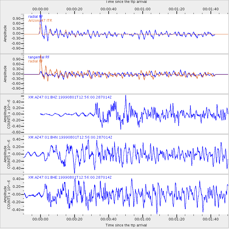
Earthquake location: Andreanof Islands, Aleutian Is.
Earthquake latitude/longitude: 51.5/-176.3
Earthquake time(UTC): 1999/08/01 (213) 12:47:50 GMT
Earthquake Depth: 33 km
Earthquake Magnitude: 5.5 MB, 5.5 MS, 5.8 MW, 5.8 MW
Earthquake Catalog/Contributor: WHDF/NEIC
Network: XM Rio Grande Seismic Transect
Station: AZ47 Arizona47
Lat/Lon: 36.64 N/109.33 W
Elevation: 1752 m
Distance: 48.6 deg
Az: 80.396 deg
Baz: 310.014 deg
Ray Param: 0.069159225
Estimated Moho Depth: 10.0 km
Estimated Crust Vp/Vs: 1.60
Assumed Crust Vp: 6.476 km/s
Estimated Crust Vs: 4.047 km/s
Estimated Crust Poisson's Ratio: 0.18
Radial Match: 84.26053 %
Radial Bump: 400
Transverse Match: 66.0859 %
Transverse Bump: 400
SOD ConfigId: 27569
Insert Time: 2010-02-26 17:19:37.819 +0000
GWidth: 2.5
Max Bumps: 400
Tol: 0.001

Signal To Noise

ChannelStoNSTALTA
XM:AZ47:01:BHN:19990801T12:56:00.287014Z1.63293588.392048E-85.1392398E-8
XM:AZ47:01:BHE:19990801T12:56:00.287014Z2.51780631.1994696E-74.763947E-8
XM:AZ47:01:BHZ:19990801T12:56:00.287014Z5.49513961.4563327E-72.6502196E-8
Arrivals
Ps1.0 SECOND
PpPs3.8 SECOND
PsPs/PpSs4.7 SECOND