You are here: Home > Network List > US - United States National Seismic Network Stations List
> Station DGMT Dagmar, Montana, USA > Earthquake Result Viewer
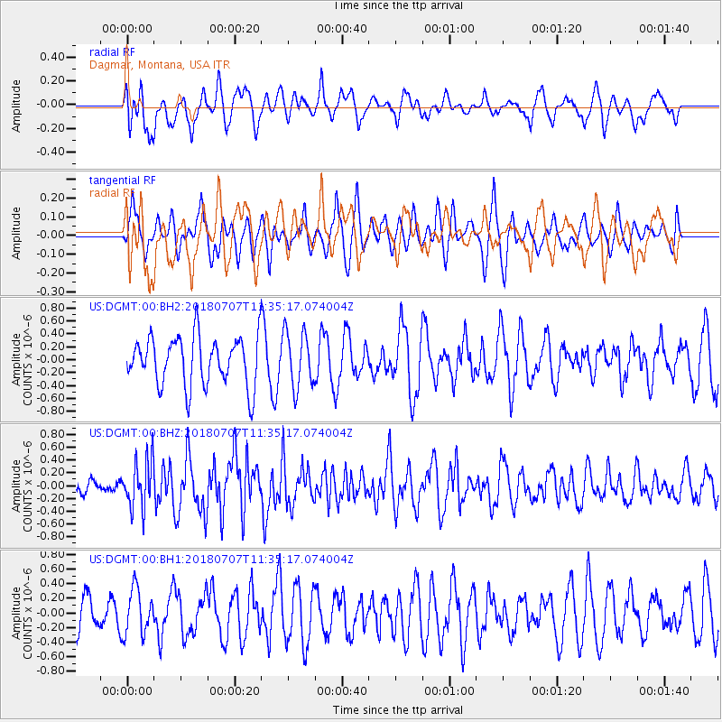
DGMT Dagmar, Montana, USA - Earthquake Result Viewer
*The percent match for this event was below the threshold and hence no stack was calculated.
| Earthquake location: |
Near East Coast Of Honshu, Japan |
| Earthquake latitude/longitude: |
35.1/140.7 |
| Earthquake time(UTC): |
2018/07/07 (188) 11:23:49 GMT |
| Earthquake Depth: |
39 km |
| Earthquake Magnitude: |
5.9 Mww |
| Earthquake Catalog/Contributor: |
NEIC PDE/us |
|
| Network: |
US United States National Seismic Network |
| Station: |
DGMT Dagmar, Montana, USA |
| Lat/Lon: |
48.47 N/104.20 W |
| Elevation: |
0.0 m |
|
| Distance: |
78.7 deg |
| Az: |
37.896 deg |
| Baz: |
310.812 deg |
| Ray Param: |
$rayparam |
*The percent match for this event was below the threshold and hence was not used in the summary stack. |
|
| Radial Match: |
53.26922 % |
| Radial Bump: |
400 |
| Transverse Match: |
54.93974 % |
| Transverse Bump: |
400 |
| SOD ConfigId: |
2752131 |
| Insert Time: |
2018-07-21 11:30:09.534 +0000 |
| GWidth: |
2.5 |
| Max Bumps: |
400 |
| Tol: |
0.001 |
|
Signal To Noise
| Channel | StoN | STA | LTA |
| US:DGMT:00:BHZ:20180707T11:35:17.074004Z | 2.5712957 | 3.7912355E-7 | 1.4744455E-7 |
| US:DGMT:00:BH1:20180707T11:35:17.074004Z | 1.4308925 | 3.0928013E-7 | 2.1614493E-7 |
| US:DGMT:00:BH2:20180707T11:35:17.074004Z | 1.1392156 | 4.3326267E-7 | 3.803167E-7 |
| Arrivals |
| Ps | |
| PpPs | |
| PsPs/PpSs | |


