You are here: Home > Network List > US - United States National Seismic Network Stations List
> Station MNTX Cornudas Mountains, Texas, USA > Earthquake Result Viewer
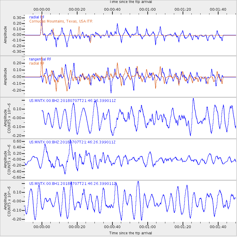
MNTX Cornudas Mountains, Texas, USA - Earthquake Result Viewer
*The percent match for this event was below the threshold and hence no stack was calculated.
| Earthquake location: |
Kermadec Islands, New Zealand |
| Earthquake latitude/longitude: |
-30.6/-178.0 |
| Earthquake time(UTC): |
2018/07/07 (188) 21:33:49 GMT |
| Earthquake Depth: |
34 km |
| Earthquake Magnitude: |
5.9 Mww |
| Earthquake Catalog/Contributor: |
NEIC PDE/us |
|
| Network: |
US United States National Seismic Network |
| Station: |
MNTX Cornudas Mountains, Texas, USA |
| Lat/Lon: |
31.70 N/105.38 W |
| Elevation: |
404 m |
|
| Distance: |
92.6 deg |
| Az: |
54.531 deg |
| Baz: |
235.458 deg |
| Ray Param: |
$rayparam |
*The percent match for this event was below the threshold and hence was not used in the summary stack. |
|
| Radial Match: |
71.92618 % |
| Radial Bump: |
400 |
| Transverse Match: |
54.169815 % |
| Transverse Bump: |
398 |
| SOD ConfigId: |
2752131 |
| Insert Time: |
2018-07-21 21:37:13.525 +0000 |
| GWidth: |
2.5 |
| Max Bumps: |
400 |
| Tol: |
0.001 |
|
Signal To Noise
| Channel | StoN | STA | LTA |
| US:MNTX:00:BHZ:20180707T21:46:26.399011Z | 2.3453057 | 2.6229205E-7 | 1.11837046E-7 |
| US:MNTX:00:BH1:20180707T21:46:26.399011Z | 0.45373034 | 4.593841E-8 | 1.01246066E-7 |
| US:MNTX:00:BH2:20180707T21:46:26.399011Z | 1.3305385 | 1.170649E-7 | 8.7983096E-8 |
| Arrivals |
| Ps | |
| PpPs | |
| PsPs/PpSs | |


