AZ49 Arizona49 - Earthquake Result Viewer
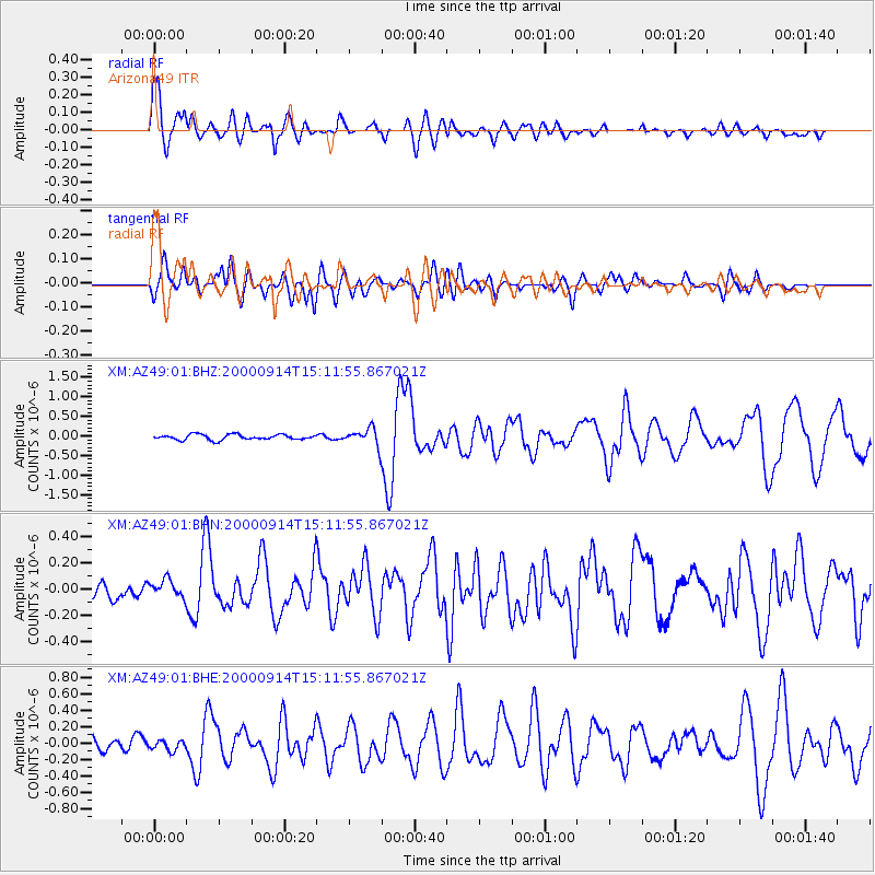
Earthquake location: Fiji Islands
Earthquake latitude/longitude: -15.7/179.8
Earthquake time(UTC): 2000/09/14 (258) 14:59:57 GMT
Earthquake Depth: 33 km
Earthquake Magnitude: 5.7 MB, 6.2 MS, 6.3 MW, 6.2 MW
Earthquake Catalog/Contributor: WHDF/NEIC
Network: XM Rio Grande Seismic Transect
Station: AZ49 Arizona49
Lat/Lon: 36.89 N/109.69 W
Elevation: 1512 m
Distance: 84.5 deg
Az: 49.406 deg
Baz: 245.787 deg
Ray Param: 0.045420885
Estimated Moho Depth: 33.75 km
Estimated Crust Vp/Vs: 1.81
Assumed Crust Vp: 6.476 km/s
Estimated Crust Vs: 3.573 km/s
Estimated Crust Poisson's Ratio: 0.28
Radial Match: 90.98215 %
Radial Bump: 400
Transverse Match: 73.93669 %
Transverse Bump: 400
SOD ConfigId: 16820
Insert Time: 2010-02-26 17:20:04.860 +0000
GWidth: 2.5
Max Bumps: 400
Tol: 0.001

Signal To Noise

ChannelStoNSTALTA
XM:AZ49:01:BHN:20000914T15:11:55.867021Z1.16813867.53909E-86.453934E-8
XM:AZ49:01:BHE:20000914T15:11:55.867021Z0.5667956.6470605E-81.1727452E-7
XM:AZ49:01:BHZ:20000914T15:11:55.867021Z3.29047852.2407667E-76.809851E-8
Arrivals
Ps4.3 SECOND
PpPs14 SECOND
PsPs/PpSs19 SECOND