AZ49 Arizona49 - Earthquake Result Viewer
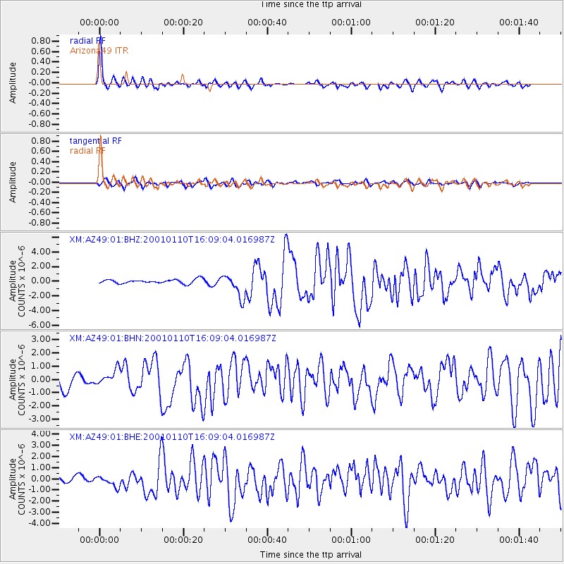
Earthquake location: Kodiak Island Region, Alaska
Earthquake latitude/longitude: 57.1/-153.2
Earthquake time(UTC): 2001/01/10 (010) 16:02:44 GMT
Earthquake Depth: 33 km
Earthquake Magnitude: 6.2 MB, 6.8 MS, 7.1 MW, 6.8 ML
Earthquake Catalog/Contributor: WHDF/NEIC
Network: XM Rio Grande Seismic Transect
Station: AZ49 Arizona49
Lat/Lon: 36.89 N/109.69 W
Elevation: 1512 m
Distance: 35.1 deg
Az: 106.227 deg
Baz: 319.159 deg
Ray Param: 0.07734078
Estimated Moho Depth: 25.75 km
Estimated Crust Vp/Vs: 1.83
Assumed Crust Vp: 6.476 km/s
Estimated Crust Vs: 3.548 km/s
Estimated Crust Poisson's Ratio: 0.29
Radial Match: 89.502045 %
Radial Bump: 318
Transverse Match: 68.081184 %
Transverse Bump: 400
SOD ConfigId: 16820
Insert Time: 2010-02-26 17:20:07.107 +0000
GWidth: 2.5
Max Bumps: 400
Tol: 0.001

Signal To Noise

ChannelStoNSTALTA
XM:AZ49:01:BHN:20010110T16:09:04.016987Z0.962751756.2342485E-76.4754477E-7
XM:AZ49:01:BHE:20010110T16:09:04.016987Z1.4043234.9362086E-73.5150094E-7
XM:AZ49:01:BHZ:20010110T16:09:04.016987Z6.05814031.6490343E-62.7220142E-7
Arrivals
Ps3.5 SECOND
PpPs10 SECOND
PsPs/PpSs14 SECOND