
AZ49 Arizona49 - Earthquake Result Viewer
| ||||||||||||||||||
| ||||||||||||||||||
| ||||||||||||||||||
|
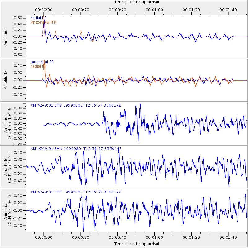
Signal To Noise
| Channel | StoN | STA | LTA |
| XM:AZ49:01:BHN:19990801T12:55:57.356014Z | 2.1714847 | 1.0135042E-7 | 4.6673332E-8 |
| XM:AZ49:01:BHE:19990801T12:55:57.356014Z | 4.82545 | 1.0218558E-7 | 2.1176383E-8 |
| XM:AZ49:01:BHZ:19990801T12:55:57.356014Z | 5.202888 | 2.5231824E-7 | 4.8495803E-8 |
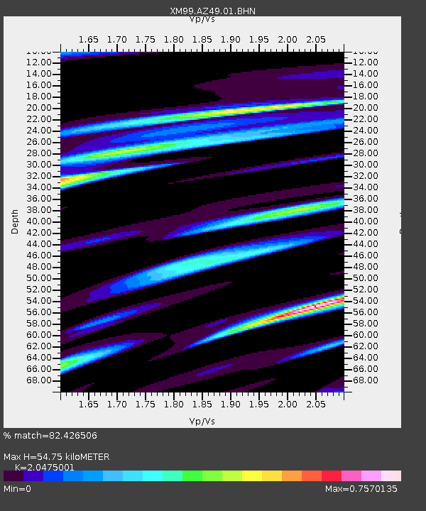
| Arrivals | |
| Ps | 9.3 SECOND |
| PpPs | 24 SECOND |
| PsPs/PpSs | 34 SECOND |

