You are here: Home > Network List > US - United States National Seismic Network Stations List
> Station HAWA Hanford, Washington, USA > Earthquake Result Viewer
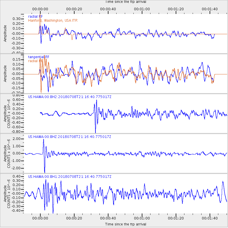
HAWA Hanford, Washington, USA - Earthquake Result Viewer
*The percent match for this event was below the threshold and hence no stack was calculated.
| Earthquake location: |
Vanuatu Islands |
| Earthquake latitude/longitude: |
-19.0/169.5 |
| Earthquake time(UTC): |
2018/07/08 (189) 21:04:36 GMT |
| Earthquake Depth: |
259 km |
| Earthquake Magnitude: |
5.5 Mww |
| Earthquake Catalog/Contributor: |
NEIC PDE/us |
|
| Network: |
US United States National Seismic Network |
| Station: |
HAWA Hanford, Washington, USA |
| Lat/Lon: |
46.39 N/119.53 W |
| Elevation: |
364 m |
|
| Distance: |
91.2 deg |
| Az: |
40.875 deg |
| Baz: |
243.431 deg |
| Ray Param: |
$rayparam |
*The percent match for this event was below the threshold and hence was not used in the summary stack. |
|
| Radial Match: |
63.078163 % |
| Radial Bump: |
400 |
| Transverse Match: |
54.69265 % |
| Transverse Bump: |
400 |
| SOD ConfigId: |
2752131 |
| Insert Time: |
2018-07-22 21:10:54.618 +0000 |
| GWidth: |
2.5 |
| Max Bumps: |
400 |
| Tol: |
0.001 |
|
Signal To Noise
| Channel | StoN | STA | LTA |
| US:HAWA:00:BHZ:20180708T21:16:40.775017Z | 12.758428 | 8.9511093E-7 | 7.015841E-8 |
| US:HAWA:00:BH1:20180708T21:16:40.775017Z | 2.4971561 | 1.7277456E-7 | 6.918853E-8 |
| US:HAWA:00:BH2:20180708T21:16:40.775017Z | 7.0564537 | 2.9960003E-7 | 4.2457593E-8 |
| Arrivals |
| Ps | |
| PpPs | |
| PsPs/PpSs | |


