You are here: Home > Network List > AZ - ANZA Regional Network Stations List
> Station SMER AZ.SMER > Earthquake Result Viewer
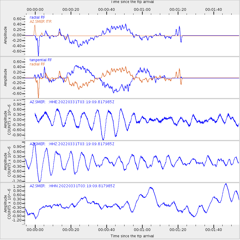
SMER AZ.SMER - Earthquake Result Viewer
*The percent match for this event was below the threshold and hence no stack was calculated.
| Earthquake location: |
Southeast Of Loyalty Islands |
| Earthquake latitude/longitude: |
-22.4/170.1 |
| Earthquake time(UTC): |
2022/03/31 (090) 03:06:47 GMT |
| Earthquake Depth: |
10 km |
| Earthquake Magnitude: |
5.7 mww |
| Earthquake Catalog/Contributor: |
NEIC PDE/us |
|
| Network: |
AZ ANZA Regional Network |
| Station: |
SMER AZ.SMER |
| Lat/Lon: |
33.46 N/117.17 W |
| Elevation: |
355 m |
|
| Distance: |
88.7 deg |
| Az: |
52.977 deg |
| Baz: |
242.111 deg |
| Ray Param: |
$rayparam |
*The percent match for this event was below the threshold and hence was not used in the summary stack. |
|
| Radial Match: |
50.33012 % |
| Radial Bump: |
400 |
| Transverse Match: |
36.57485 % |
| Transverse Bump: |
400 |
| SOD ConfigId: |
27527651 |
| Insert Time: |
2022-04-14 03:13:35.084 +0000 |
| GWidth: |
2.5 |
| Max Bumps: |
400 |
| Tol: |
0.001 |
|
Signal To Noise
| Channel | StoN | STA | LTA |
| AZ:SMER: :HHZ:20220331T03:19:09.817985Z | 8.73726 | 8.451756E-7 | 9.6732336E-8 |
| AZ:SMER: :HHN:20220331T03:19:09.817985Z | 3.331428 | 1.1906083E-6 | 3.5738677E-7 |
| AZ:SMER: :HHE:20220331T03:19:09.817985Z | 1.3773253 | 4.2531667E-7 | 3.08799E-7 |
| Arrivals |
| Ps | |
| PpPs | |
| PsPs/PpSs | |


