You are here: Home > Network List > BK - Berkeley Digital Seismograph Network Stations List
> Station HUMO Hull Mountain, OR > Earthquake Result Viewer
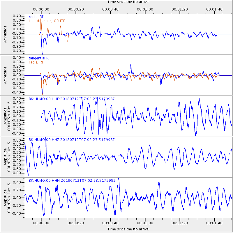
HUMO Hull Mountain, OR - Earthquake Result Viewer
*The percent match for this event was below the threshold and hence no stack was calculated.
| Earthquake location: |
South Of Fiji Islands |
| Earthquake latitude/longitude: |
-23.3/-179.9 |
| Earthquake time(UTC): |
2018/07/12 (193) 06:51:21 GMT |
| Earthquake Depth: |
540 km |
| Earthquake Magnitude: |
5.5 Mww |
| Earthquake Catalog/Contributor: |
NEIC PDE/us |
|
| Network: |
BK Berkeley Digital Seismograph Network |
| Station: |
HUMO Hull Mountain, OR |
| Lat/Lon: |
42.61 N/122.96 W |
| Elevation: |
555 m |
|
| Distance: |
84.0 deg |
| Az: |
38.477 deg |
| Baz: |
230.768 deg |
| Ray Param: |
$rayparam |
*The percent match for this event was below the threshold and hence was not used in the summary stack. |
|
| Radial Match: |
75.62336 % |
| Radial Bump: |
400 |
| Transverse Match: |
66.214714 % |
| Transverse Bump: |
400 |
| SOD ConfigId: |
2768671 |
| Insert Time: |
2018-07-26 06:55:35.279 +0000 |
| GWidth: |
2.5 |
| Max Bumps: |
400 |
| Tol: |
0.001 |
|
Signal To Noise
| Channel | StoN | STA | LTA |
| BK:HUMO:00:HHZ:20180712T07:02:23.517998Z | 1.2986503 | 3.8786754E-7 | 2.9866973E-7 |
| BK:HUMO:00:HHN:20180712T07:02:23.517998Z | 2.341656 | 2.690525E-7 | 1.1489838E-7 |
| BK:HUMO:00:HHE:20180712T07:02:23.517998Z | 1.8202939 | 2.7896579E-7 | 1.5325315E-7 |
| Arrivals |
| Ps | |
| PpPs | |
| PsPs/PpSs | |


