You are here: Home > Network List > US - United States National Seismic Network Stations List
> Station DUG Dugway, Tooele County, Utah, USA > Earthquake Result Viewer
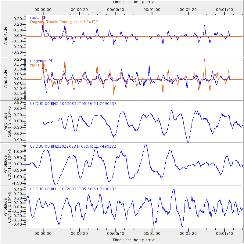
DUG Dugway, Tooele County, Utah, USA - Earthquake Result Viewer
*The percent match for this event was below the threshold and hence no stack was calculated.
| Earthquake location: |
Southeast Of Loyalty Islands |
| Earthquake latitude/longitude: |
-22.7/170.3 |
| Earthquake time(UTC): |
2022/03/31 (090) 05:44:01 GMT |
| Earthquake Depth: |
10 km |
| Earthquake Magnitude: |
7.2 Mi |
| Earthquake Catalog/Contributor: |
NEIC PDE/at |
|
| Network: |
US United States National Seismic Network |
| Station: |
DUG Dugway, Tooele County, Utah, USA |
| Lat/Lon: |
40.19 N/112.81 W |
| Elevation: |
1477 m |
|
| Distance: |
94.9 deg |
| Az: |
48.486 deg |
| Baz: |
244.52 deg |
| Ray Param: |
$rayparam |
*The percent match for this event was below the threshold and hence was not used in the summary stack. |
|
| Radial Match: |
81.66094 % |
| Radial Bump: |
324 |
| Transverse Match: |
76.02845 % |
| Transverse Bump: |
400 |
| SOD ConfigId: |
27527651 |
| Insert Time: |
2022-04-14 06:07:42.580 +0000 |
| GWidth: |
2.5 |
| Max Bumps: |
400 |
| Tol: |
0.001 |
|
Signal To Noise
| Channel | StoN | STA | LTA |
| US:DUG:00:BHZ:20220331T05:56:51.749023Z | 7.717468 | 9.4058424E-7 | 1.218773E-7 |
| US:DUG:00:BH1:20220331T05:56:51.749023Z | 0.6561044 | 8.3997485E-8 | 1.2802458E-7 |
| US:DUG:00:BH2:20220331T05:56:51.749023Z | 1.4023664 | 2.6761336E-7 | 1.9082984E-7 |
| Arrivals |
| Ps | |
| PpPs | |
| PsPs/PpSs | |


