You are here: Home > Network List > US - United States National Seismic Network Stations List
> Station MNTX Cornudas Mountains, Texas, USA > Earthquake Result Viewer
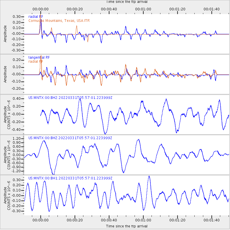
MNTX Cornudas Mountains, Texas, USA - Earthquake Result Viewer
*The percent match for this event was below the threshold and hence no stack was calculated.
| Earthquake location: |
Southeast Of Loyalty Islands |
| Earthquake latitude/longitude: |
-22.7/170.3 |
| Earthquake time(UTC): |
2022/03/31 (090) 05:44:01 GMT |
| Earthquake Depth: |
10 km |
| Earthquake Magnitude: |
7.2 Mi |
| Earthquake Catalog/Contributor: |
NEIC PDE/at |
|
| Network: |
US United States National Seismic Network |
| Station: |
MNTX Cornudas Mountains, Texas, USA |
| Lat/Lon: |
31.70 N/105.38 W |
| Elevation: |
405 m |
|
| Distance: |
97.0 deg |
| Az: |
58.723 deg |
| Baz: |
247.807 deg |
| Ray Param: |
$rayparam |
*The percent match for this event was below the threshold and hence was not used in the summary stack. |
|
| Radial Match: |
75.017334 % |
| Radial Bump: |
400 |
| Transverse Match: |
51.34876 % |
| Transverse Bump: |
400 |
| SOD ConfigId: |
27527651 |
| Insert Time: |
2022-04-14 06:07:51.414 +0000 |
| GWidth: |
2.5 |
| Max Bumps: |
400 |
| Tol: |
0.001 |
|
Signal To Noise
| Channel | StoN | STA | LTA |
| US:MNTX:00:BHZ:20220331T05:57:01.223999Z | 5.903094 | 7.653606E-7 | 1.2965415E-7 |
| US:MNTX:00:BH1:20220331T05:57:01.223999Z | 1.3080645 | 1.7524738E-7 | 1.3397458E-7 |
| US:MNTX:00:BH2:20220331T05:57:01.223999Z | 1.2863808 | 1.8801327E-7 | 1.4615678E-7 |
| Arrivals |
| Ps | |
| PpPs | |
| PsPs/PpSs | |


