You are here: Home > Network List > UU - University of Utah Regional Network Stations List
> Station FORU South Mineral Mountains, UT, USA > Earthquake Result Viewer
FORU South Mineral Mountains, UT, USA - Earthquake Result Viewer
*The percent match for this event was below the threshold and hence no stack was calculated.
| Earthquake location: |
Southeast Of Loyalty Islands |
| Earthquake latitude/longitude: |
-22.5/170.4 |
| Earthquake time(UTC): |
2022/03/31 (090) 06:02:09 GMT |
| Earthquake Depth: |
10 km |
| Earthquake Magnitude: |
5.9 Mww |
| Earthquake Catalog/Contributor: |
NEIC PDE/us |
|
| Network: |
UU University of Utah Regional Network |
| Station: |
FORU South Mineral Mountains, UT, USA |
| Lat/Lon: |
38.46 N/112.86 W |
| Elevation: |
1840 m |
|
| Distance: |
94.0 deg |
| Az: |
50.002 deg |
| Baz: |
244.489 deg |
| Ray Param: |
$rayparam |
*The percent match for this event was below the threshold and hence was not used in the summary stack. |
|
| Radial Match: |
65.49192 % |
| Radial Bump: |
400 |
| Transverse Match: |
70.90489 % |
| Transverse Bump: |
334 |
| SOD ConfigId: |
27527651 |
| Insert Time: |
2022-04-14 06:23:57.045 +0000 |
| GWidth: |
2.5 |
| Max Bumps: |
400 |
| Tol: |
0.001 |
|
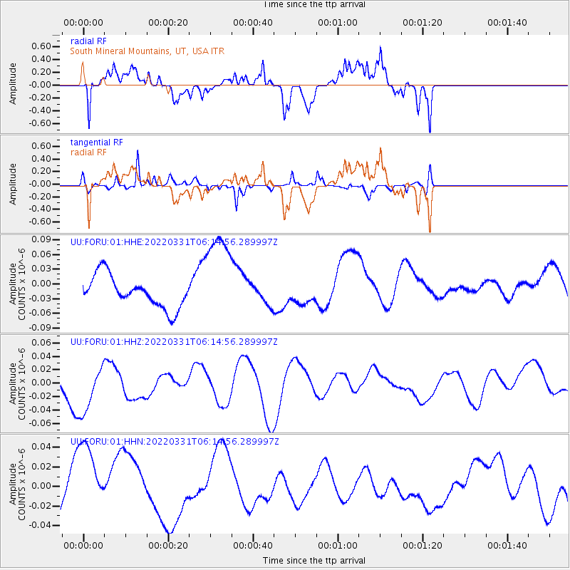
Signal To Noise
| Channel | StoN | STA | LTA |
| UU:FORU:01:HHZ:20220331T06:14:56.289997Z | 1.5341762 | 3.7483172E-8 | 2.4432115E-8 |
| UU:FORU:01:HHN:20220331T06:14:56.289997Z | 0.9056487 | 3.7315022E-8 | 4.1202536E-8 |
| UU:FORU:01:HHE:20220331T06:14:56.289997Z | 3.0398726 | 9.6524026E-8 | 3.1752656E-8 |
| Arrivals |
| Ps | |
| PpPs | |
| PsPs/PpSs | |


