You are here: Home > Network List > US - United States National Seismic Network Stations List
> Station MNTX Cornudas Mountains, Texas, USA > Earthquake Result Viewer
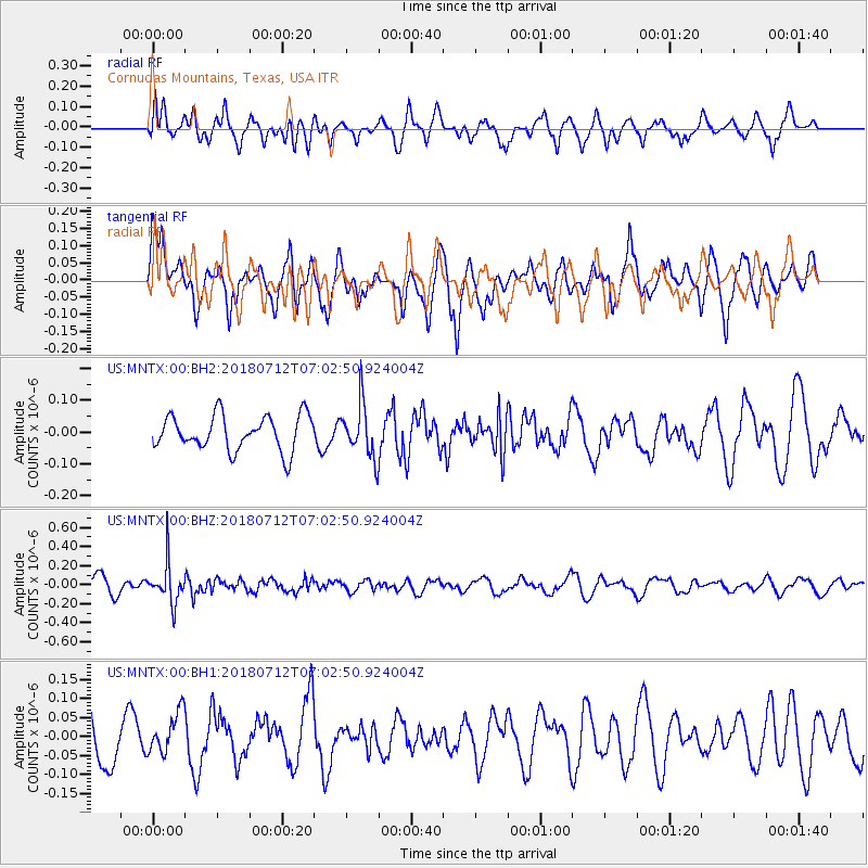
MNTX Cornudas Mountains, Texas, USA - Earthquake Result Viewer
*The percent match for this event was below the threshold and hence no stack was calculated.
| Earthquake location: |
South Of Fiji Islands |
| Earthquake latitude/longitude: |
-23.3/-179.9 |
| Earthquake time(UTC): |
2018/07/12 (193) 06:51:21 GMT |
| Earthquake Depth: |
540 km |
| Earthquake Magnitude: |
5.5 Mww |
| Earthquake Catalog/Contributor: |
NEIC PDE/us |
|
| Network: |
US United States National Seismic Network |
| Station: |
MNTX Cornudas Mountains, Texas, USA |
| Lat/Lon: |
31.70 N/105.38 W |
| Elevation: |
404 m |
|
| Distance: |
89.8 deg |
| Az: |
55.235 deg |
| Baz: |
242.346 deg |
| Ray Param: |
$rayparam |
*The percent match for this event was below the threshold and hence was not used in the summary stack. |
|
| Radial Match: |
49.083263 % |
| Radial Bump: |
400 |
| Transverse Match: |
52.555603 % |
| Transverse Bump: |
400 |
| SOD ConfigId: |
2768671 |
| Insert Time: |
2018-07-26 06:58:40.078 +0000 |
| GWidth: |
2.5 |
| Max Bumps: |
400 |
| Tol: |
0.001 |
|
Signal To Noise
| Channel | StoN | STA | LTA |
| US:MNTX:00:BHZ:20180712T07:02:50.924004Z | 2.090638 | 2.0760005E-7 | 9.9299854E-8 |
| US:MNTX:00:BH1:20180712T07:02:50.924004Z | 0.7815979 | 5.4705204E-8 | 6.999149E-8 |
| US:MNTX:00:BH2:20180712T07:02:50.924004Z | 1.5005922 | 8.212748E-8 | 5.473004E-8 |
| Arrivals |
| Ps | |
| PpPs | |
| PsPs/PpSs | |


