You are here: Home > Network List > US - United States National Seismic Network Stations List
> Station MSO Missoula, Montana, USA > Earthquake Result Viewer
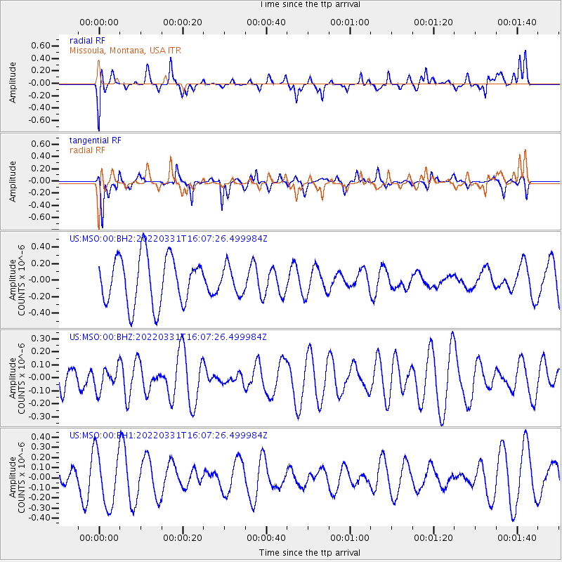
MSO Missoula, Montana, USA - Earthquake Result Viewer
*The percent match for this event was below the threshold and hence no stack was calculated.
| Earthquake location: |
Southeast Of Loyalty Islands |
| Earthquake latitude/longitude: |
-22.2/170.2 |
| Earthquake time(UTC): |
2022/03/31 (090) 15:54:27 GMT |
| Earthquake Depth: |
10 km |
| Earthquake Magnitude: |
5.4 Mww |
| Earthquake Catalog/Contributor: |
NEIC PDE/us |
|
| Network: |
US United States National Seismic Network |
| Station: |
MSO Missoula, Montana, USA |
| Lat/Lon: |
46.83 N/113.94 W |
| Elevation: |
1264 m |
|
| Distance: |
96.8 deg |
| Az: |
42.096 deg |
| Baz: |
244.774 deg |
| Ray Param: |
$rayparam |
*The percent match for this event was below the threshold and hence was not used in the summary stack. |
|
| Radial Match: |
61.829617 % |
| Radial Bump: |
400 |
| Transverse Match: |
61.552097 % |
| Transverse Bump: |
292 |
| SOD ConfigId: |
27527651 |
| Insert Time: |
2022-04-14 16:07:38.946 +0000 |
| GWidth: |
2.5 |
| Max Bumps: |
400 |
| Tol: |
0.001 |
|
Signal To Noise
| Channel | StoN | STA | LTA |
| US:MSO:00:BHZ:20220331T16:07:26.499984Z | 0.5463283 | 8.9149495E-8 | 1.6317935E-7 |
| US:MSO:00:BH1:20220331T16:07:26.499984Z | 1.8219472 | 2.685788E-7 | 1.4741303E-7 |
| US:MSO:00:BH2:20220331T16:07:26.499984Z | 0.575113 | 1.684582E-7 | 2.9291323E-7 |
| Arrivals |
| Ps | |
| PpPs | |
| PsPs/PpSs | |


