You are here: Home > Network List > IW - Intermountain West Stations List
> Station MOOW Moose Ponds, Wyoming, USA > Earthquake Result Viewer
MOOW Moose Ponds, Wyoming, USA - Earthquake Result Viewer
*The percent match for this event was below the threshold and hence no stack was calculated.
| Earthquake location: |
Southeast Of Loyalty Islands |
| Earthquake latitude/longitude: |
-22.7/170.7 |
| Earthquake time(UTC): |
2022/03/31 (090) 19:50:40 GMT |
| Earthquake Depth: |
10 km |
| Earthquake Magnitude: |
6.3 mww |
| Earthquake Catalog/Contributor: |
NEIC PDE/us |
|
| Network: |
IW Intermountain West |
| Station: |
MOOW Moose Ponds, Wyoming, USA |
| Lat/Lon: |
43.75 N/110.74 W |
| Elevation: |
2128 m |
|
| Distance: |
97.6 deg |
| Az: |
45.785 deg |
| Baz: |
245.937 deg |
| Ray Param: |
$rayparam |
*The percent match for this event was below the threshold and hence was not used in the summary stack. |
|
| Radial Match: |
74.68494 % |
| Radial Bump: |
400 |
| Transverse Match: |
59.16009 % |
| Transverse Bump: |
400 |
| SOD ConfigId: |
27527651 |
| Insert Time: |
2022-04-14 20:01:52.227 +0000 |
| GWidth: |
2.5 |
| Max Bumps: |
400 |
| Tol: |
0.001 |
|
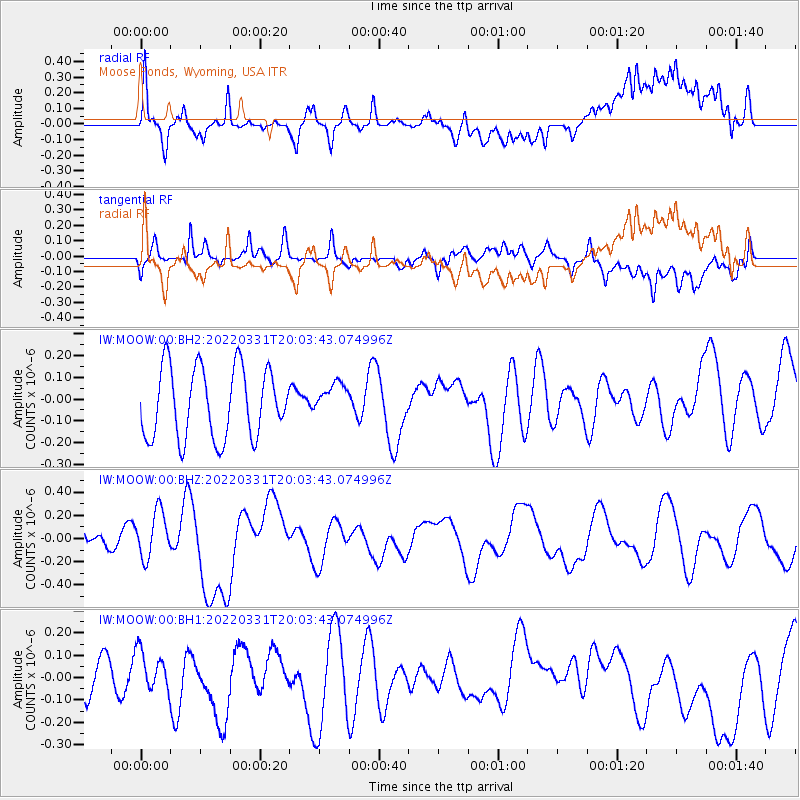
Signal To Noise
| Channel | StoN | STA | LTA |
| IW:MOOW:00:BHZ:20220331T20:03:43.074996Z | 2.251494 | 2.0025827E-7 | 8.894462E-8 |
| IW:MOOW:00:BH1:20220331T20:03:43.074996Z | 1.4726071 | 8.199619E-8 | 5.5680967E-8 |
| IW:MOOW:00:BH2:20220331T20:03:43.074996Z | 0.46345562 | 7.453018E-8 | 1.6081405E-7 |
| Arrivals |
| Ps | |
| PpPs | |
| PsPs/PpSs | |


