You are here: Home > Network List > US - United States National Seismic Network Stations List
> Station MSO Missoula, Montana, USA > Earthquake Result Viewer
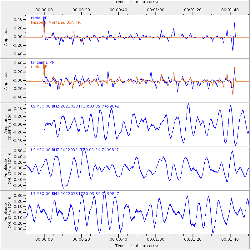
MSO Missoula, Montana, USA - Earthquake Result Viewer
*The percent match for this event was below the threshold and hence no stack was calculated.
| Earthquake location: |
Southeast Of Loyalty Islands |
| Earthquake latitude/longitude: |
-22.7/170.7 |
| Earthquake time(UTC): |
2022/03/31 (090) 19:50:40 GMT |
| Earthquake Depth: |
10 km |
| Earthquake Magnitude: |
6.3 mww |
| Earthquake Catalog/Contributor: |
NEIC PDE/us |
|
| Network: |
US United States National Seismic Network |
| Station: |
MSO Missoula, Montana, USA |
| Lat/Lon: |
46.83 N/113.94 W |
| Elevation: |
1264 m |
|
| Distance: |
96.9 deg |
| Az: |
42.011 deg |
| Baz: |
244.149 deg |
| Ray Param: |
$rayparam |
*The percent match for this event was below the threshold and hence was not used in the summary stack. |
|
| Radial Match: |
51.231266 % |
| Radial Bump: |
367 |
| Transverse Match: |
40.15454 % |
| Transverse Bump: |
386 |
| SOD ConfigId: |
27527651 |
| Insert Time: |
2022-04-14 20:05:43.193 +0000 |
| GWidth: |
2.5 |
| Max Bumps: |
400 |
| Tol: |
0.001 |
|
Signal To Noise
| Channel | StoN | STA | LTA |
| US:MSO:00:BHZ:20220331T20:03:39.749984Z | 1.5237584 | 2.0654143E-7 | 1.3554737E-7 |
| US:MSO:00:BH1:20220331T20:03:39.749984Z | 0.94864553 | 8.613453E-8 | 9.079737E-8 |
| US:MSO:00:BH2:20220331T20:03:39.749984Z | 2.020539 | 2.5847044E-7 | 1.2792152E-7 |
| Arrivals |
| Ps | |
| PpPs | |
| PsPs/PpSs | |


