You are here: Home > Network List > UW - Pacific Northwest Regional Seismic Network Stations List
> Station UMAT Pilot Rock, OR, USA > Earthquake Result Viewer
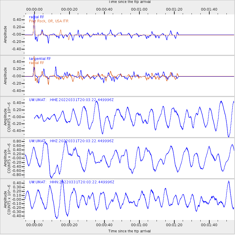
UMAT Pilot Rock, OR, USA - Earthquake Result Viewer
*The percent match for this event was below the threshold and hence no stack was calculated.
| Earthquake location: |
Southeast Of Loyalty Islands |
| Earthquake latitude/longitude: |
-22.7/170.7 |
| Earthquake time(UTC): |
2022/03/31 (090) 19:50:40 GMT |
| Earthquake Depth: |
10 km |
| Earthquake Magnitude: |
6.3 mww |
| Earthquake Catalog/Contributor: |
NEIC PDE/us |
|
| Network: |
UW Pacific Northwest Regional Seismic Network |
| Station: |
UMAT Pilot Rock, OR, USA |
| Lat/Lon: |
45.29 N/118.96 W |
| Elevation: |
1318 m |
|
| Distance: |
93.1 deg |
| Az: |
41.751 deg |
| Baz: |
240.567 deg |
| Ray Param: |
$rayparam |
*The percent match for this event was below the threshold and hence was not used in the summary stack. |
|
| Radial Match: |
67.69873 % |
| Radial Bump: |
400 |
| Transverse Match: |
67.25839 % |
| Transverse Bump: |
270 |
| SOD ConfigId: |
27527651 |
| Insert Time: |
2022-04-14 20:06:43.676 +0000 |
| GWidth: |
2.5 |
| Max Bumps: |
400 |
| Tol: |
0.001 |
|
Signal To Noise
| Channel | StoN | STA | LTA |
| UW:UMAT: :HHZ:20220331T20:03:22.449996Z | 2.335217 | 3.2379194E-7 | 1.3865603E-7 |
| UW:UMAT: :HHN:20220331T20:03:22.449996Z | 1.0825428 | 1.4479072E-7 | 1.3375058E-7 |
| UW:UMAT: :HHE:20220331T20:03:22.449996Z | 2.3826232 | 2.2172922E-7 | 9.306096E-8 |
| Arrivals |
| Ps | |
| PpPs | |
| PsPs/PpSs | |


