You are here: Home > Network List > US - United States National Seismic Network Stations List
> Station HAWA Hanford, Washington, USA > Earthquake Result Viewer
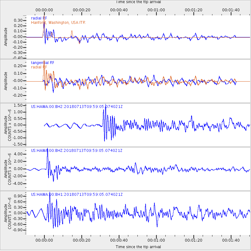
HAWA Hanford, Washington, USA - Earthquake Result Viewer
*The percent match for this event was below the threshold and hence no stack was calculated.
| Earthquake location: |
Vanuatu Islands |
| Earthquake latitude/longitude: |
-18.9/169.0 |
| Earthquake time(UTC): |
2018/07/13 (194) 09:46:49 GMT |
| Earthquake Depth: |
169 km |
| Earthquake Magnitude: |
6.4 Mww |
| Earthquake Catalog/Contributor: |
NEIC PDE/us |
|
| Network: |
US United States National Seismic Network |
| Station: |
HAWA Hanford, Washington, USA |
| Lat/Lon: |
46.39 N/119.53 W |
| Elevation: |
364 m |
|
| Distance: |
91.4 deg |
| Az: |
41.022 deg |
| Baz: |
243.847 deg |
| Ray Param: |
$rayparam |
*The percent match for this event was below the threshold and hence was not used in the summary stack. |
|
| Radial Match: |
76.475395 % |
| Radial Bump: |
400 |
| Transverse Match: |
63.33006 % |
| Transverse Bump: |
400 |
| SOD ConfigId: |
2768671 |
| Insert Time: |
2018-07-27 09:50:49.323 +0000 |
| GWidth: |
2.5 |
| Max Bumps: |
400 |
| Tol: |
0.001 |
|
Signal To Noise
| Channel | StoN | STA | LTA |
| US:HAWA:00:BHZ:20180713T09:59:05.074021Z | 11.135608 | 1.8356757E-6 | 1.6484736E-7 |
| US:HAWA:00:BH1:20180713T09:59:05.074021Z | 3.9082587 | 4.108887E-7 | 1.0513345E-7 |
| US:HAWA:00:BH2:20180713T09:59:05.074021Z | 6.2254324 | 6.3075623E-7 | 1.0131926E-7 |
| Arrivals |
| Ps | |
| PpPs | |
| PsPs/PpSs | |


