You are here: Home > Network List > US - United States National Seismic Network Stations List
> Station WMOK Wichita Mountains, Oklahoma, USA > Earthquake Result Viewer
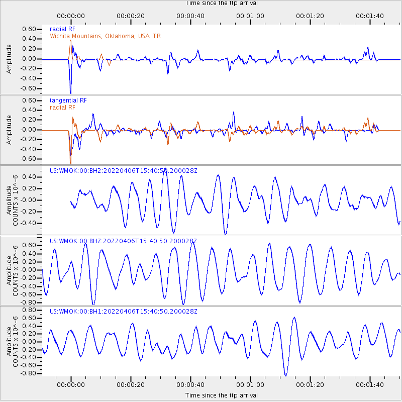
WMOK Wichita Mountains, Oklahoma, USA - Earthquake Result Viewer
*The percent match for this event was below the threshold and hence no stack was calculated.
| Earthquake location: |
Kermadec Islands Region |
| Earthquake latitude/longitude: |
-27.0/-176.4 |
| Earthquake time(UTC): |
2022/04/06 (096) 15:27:56 GMT |
| Earthquake Depth: |
11 km |
| Earthquake Magnitude: |
5.5 Mww |
| Earthquake Catalog/Contributor: |
NEIC PDE/us |
|
| Network: |
US United States National Seismic Network |
| Station: |
WMOK Wichita Mountains, Oklahoma, USA |
| Lat/Lon: |
34.74 N/98.78 W |
| Elevation: |
486 m |
|
| Distance: |
95.6 deg |
| Az: |
53.92 deg |
| Baz: |
241.088 deg |
| Ray Param: |
$rayparam |
*The percent match for this event was below the threshold and hence was not used in the summary stack. |
|
| Radial Match: |
64.65253 % |
| Radial Bump: |
400 |
| Transverse Match: |
61.166348 % |
| Transverse Bump: |
400 |
| SOD ConfigId: |
27527651 |
| Insert Time: |
2022-04-20 15:45:01.038 +0000 |
| GWidth: |
2.5 |
| Max Bumps: |
400 |
| Tol: |
0.001 |
|
Signal To Noise
| Channel | StoN | STA | LTA |
| US:WMOK:00:BHZ:20220406T15:40:50.200028Z | 0.8113889 | 3.1641278E-7 | 3.8996438E-7 |
| US:WMOK:00:BH1:20220406T15:40:50.200028Z | 0.86917347 | 2.384792E-7 | 2.7437468E-7 |
| US:WMOK:00:BH2:20220406T15:40:50.200028Z | 2.1972854 | 4.0318554E-7 | 1.8349256E-7 |
| Arrivals |
| Ps | |
| PpPs | |
| PsPs/PpSs | |


