You are here: Home > Network List > US - United States National Seismic Network Stations List
> Station HAWA Hanford, Washington, USA > Earthquake Result Viewer
HAWA Hanford, Washington, USA - Earthquake Result Viewer
*The percent match for this event was below the threshold and hence no stack was calculated.
| Earthquake location: |
Rat Islands, Aleutian Islands |
| Earthquake latitude/longitude: |
51.1/178.7 |
| Earthquake time(UTC): |
2022/04/09 (099) 16:29:16 GMT |
| Earthquake Depth: |
25 km |
| Earthquake Magnitude: |
5.7 mww |
| Earthquake Catalog/Contributor: |
NEIC PDE/us |
|
| Network: |
US United States National Seismic Network |
| Station: |
HAWA Hanford, Washington, USA |
| Lat/Lon: |
46.39 N/119.53 W |
| Elevation: |
364 m |
|
| Distance: |
39.9 deg |
| Az: |
71.838 deg |
| Baz: |
300.153 deg |
| Ray Param: |
$rayparam |
*The percent match for this event was below the threshold and hence was not used in the summary stack. |
|
| Radial Match: |
52.588158 % |
| Radial Bump: |
400 |
| Transverse Match: |
53.21561 % |
| Transverse Bump: |
400 |
| SOD ConfigId: |
27527651 |
| Insert Time: |
2022-04-23 16:51:56.890 +0000 |
| GWidth: |
2.5 |
| Max Bumps: |
400 |
| Tol: |
0.001 |
|
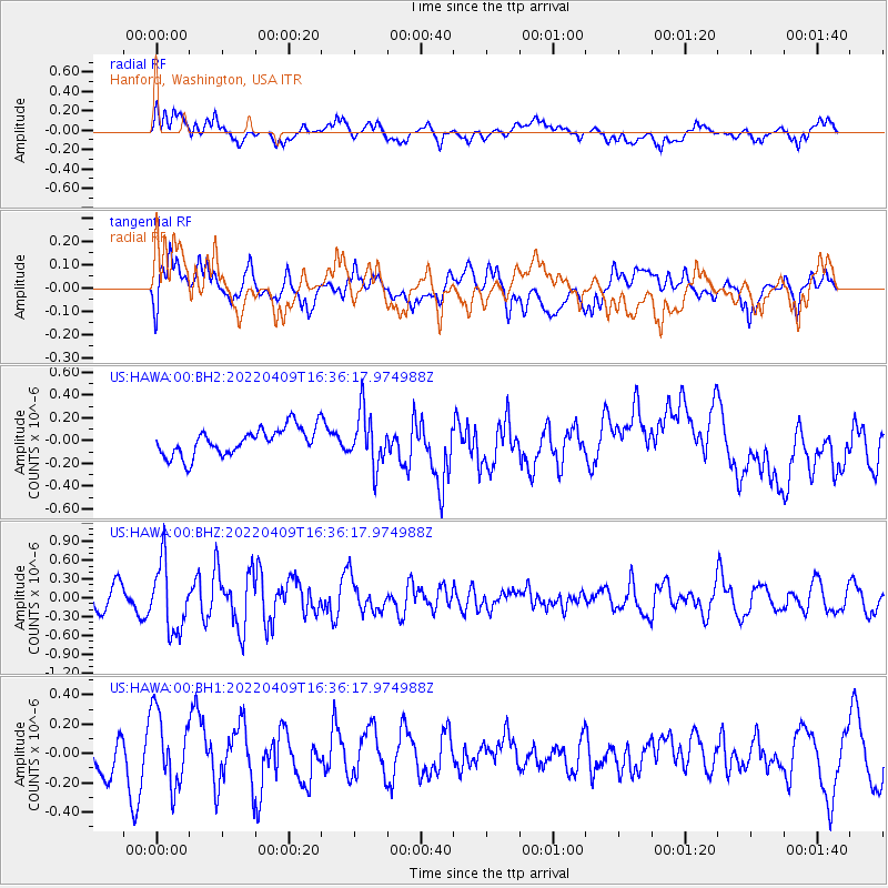
Signal To Noise
| Channel | StoN | STA | LTA |
| US:HAWA:00:BHZ:20220409T16:36:17.974988Z | 2.5179827 | 5.407044E-7 | 2.1473714E-7 |
| US:HAWA:00:BH1:20220409T16:36:17.974988Z | 1.3277478 | 2.4791183E-7 | 1.8671606E-7 |
| US:HAWA:00:BH2:20220409T16:36:17.974988Z | 1.9191488 | 2.3057092E-7 | 1.2014229E-7 |
| Arrivals |
| Ps | |
| PpPs | |
| PsPs/PpSs | |


