You are here: Home > Network List > US - United States National Seismic Network Stations List
> Station MSO Missoula, Montana, USA > Earthquake Result Viewer
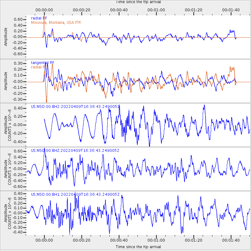
MSO Missoula, Montana, USA - Earthquake Result Viewer
*The percent match for this event was below the threshold and hence no stack was calculated.
| Earthquake location: |
Rat Islands, Aleutian Islands |
| Earthquake latitude/longitude: |
51.1/178.7 |
| Earthquake time(UTC): |
2022/04/09 (099) 16:29:16 GMT |
| Earthquake Depth: |
25 km |
| Earthquake Magnitude: |
5.7 mww |
| Earthquake Catalog/Contributor: |
NEIC PDE/us |
|
| Network: |
US United States National Seismic Network |
| Station: |
MSO Missoula, Montana, USA |
| Lat/Lon: |
46.83 N/113.94 W |
| Elevation: |
1264 m |
|
| Distance: |
43.0 deg |
| Az: |
68.286 deg |
| Baz: |
301.542 deg |
| Ray Param: |
$rayparam |
*The percent match for this event was below the threshold and hence was not used in the summary stack. |
|
| Radial Match: |
60.92944 % |
| Radial Bump: |
400 |
| Transverse Match: |
69.81166 % |
| Transverse Bump: |
400 |
| SOD ConfigId: |
27527651 |
| Insert Time: |
2022-04-23 16:52:09.883 +0000 |
| GWidth: |
2.5 |
| Max Bumps: |
400 |
| Tol: |
0.001 |
|
Signal To Noise
| Channel | StoN | STA | LTA |
| US:MSO:00:BHZ:20220409T16:36:43.249005Z | 2.2671208 | 3.5452373E-7 | 1.563762E-7 |
| US:MSO:00:BH1:20220409T16:36:43.249005Z | 1.3999447 | 1.2534893E-7 | 8.9538496E-8 |
| US:MSO:00:BH2:20220409T16:36:43.249005Z | 1.811055 | 2.9425888E-7 | 1.6247928E-7 |
| Arrivals |
| Ps | |
| PpPs | |
| PsPs/PpSs | |


