You are here: Home > Network List > UW - Pacific Northwest Regional Seismic Network Stations List
> Station HOOD Mt Hood Meadows, OR CREST BB SMO > Earthquake Result Viewer
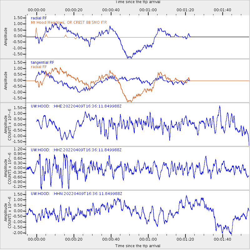
HOOD Mt Hood Meadows, OR CREST BB SMO - Earthquake Result Viewer
*The percent match for this event was below the threshold and hence no stack was calculated.
| Earthquake location: |
Rat Islands, Aleutian Islands |
| Earthquake latitude/longitude: |
51.1/178.7 |
| Earthquake time(UTC): |
2022/04/09 (099) 16:29:16 GMT |
| Earthquake Depth: |
25 km |
| Earthquake Magnitude: |
5.7 mww |
| Earthquake Catalog/Contributor: |
NEIC PDE/us |
|
| Network: |
UW Pacific Northwest Regional Seismic Network |
| Station: |
HOOD Mt Hood Meadows, OR CREST BB SMO |
| Lat/Lon: |
45.32 N/121.65 W |
| Elevation: |
1520 m |
|
| Distance: |
39.2 deg |
| Az: |
74.467 deg |
| Baz: |
300.664 deg |
| Ray Param: |
$rayparam |
*The percent match for this event was below the threshold and hence was not used in the summary stack. |
|
| Radial Match: |
45.8513 % |
| Radial Bump: |
400 |
| Transverse Match: |
38.89492 % |
| Transverse Bump: |
400 |
| SOD ConfigId: |
27527651 |
| Insert Time: |
2022-04-23 16:52:51.523 +0000 |
| GWidth: |
2.5 |
| Max Bumps: |
400 |
| Tol: |
0.001 |
|
Signal To Noise
| Channel | StoN | STA | LTA |
| UW:HOOD: :HHZ:20220409T16:36:11.849988Z | 3.3407903 | 5.802456E-7 | 1.7368515E-7 |
| UW:HOOD: :HHN:20220409T16:36:11.849988Z | 0.4101835 | 3.4258582E-7 | 8.3520143E-7 |
| UW:HOOD: :HHE:20220409T16:36:11.849988Z | 1.1994927 | 6.9402944E-7 | 5.7860245E-7 |
| Arrivals |
| Ps | |
| PpPs | |
| PsPs/PpSs | |


