You are here: Home > Network List > US - United States National Seismic Network Stations List
> Station HAWA Hanford, Washington, USA > Earthquake Result Viewer
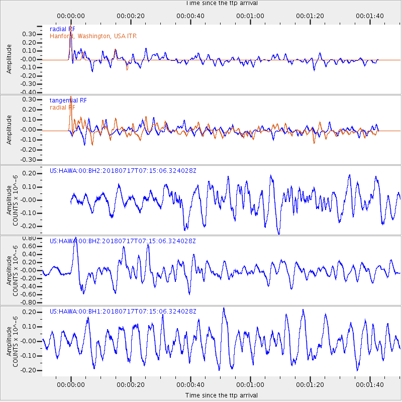
HAWA Hanford, Washington, USA - Earthquake Result Viewer
*The percent match for this event was below the threshold and hence no stack was calculated.
| Earthquake location: |
Santa Cruz Islands |
| Earthquake latitude/longitude: |
-11.7/166.3 |
| Earthquake time(UTC): |
2018/07/17 (198) 07:02:55 GMT |
| Earthquake Depth: |
60 km |
| Earthquake Magnitude: |
5.9 Mww |
| Earthquake Catalog/Contributor: |
NEIC PDE/us |
|
| Network: |
US United States National Seismic Network |
| Station: |
HAWA Hanford, Washington, USA |
| Lat/Lon: |
46.39 N/119.53 W |
| Elevation: |
364 m |
|
| Distance: |
87.7 deg |
| Az: |
41.783 deg |
| Baz: |
250.556 deg |
| Ray Param: |
$rayparam |
*The percent match for this event was below the threshold and hence was not used in the summary stack. |
|
| Radial Match: |
72.12861 % |
| Radial Bump: |
400 |
| Transverse Match: |
62.872498 % |
| Transverse Bump: |
358 |
| SOD ConfigId: |
2768671 |
| Insert Time: |
2018-07-31 07:06:23.912 +0000 |
| GWidth: |
2.5 |
| Max Bumps: |
400 |
| Tol: |
0.001 |
|
Signal To Noise
| Channel | StoN | STA | LTA |
| US:HAWA:00:BHZ:20180717T07:15:06.324028Z | 7.401859 | 4.4960586E-7 | 6.0742295E-8 |
| US:HAWA:00:BH1:20180717T07:15:06.324028Z | 1.3728306 | 4.5521627E-8 | 3.3158955E-8 |
| US:HAWA:00:BH2:20180717T07:15:06.324028Z | 1.352647 | 6.762018E-8 | 4.999101E-8 |
| Arrivals |
| Ps | |
| PpPs | |
| PsPs/PpSs | |


