You are here: Home > Network List > IW - Intermountain West Stations List
> Station MOOW Moose Ponds, Wyoming, USA > Earthquake Result Viewer
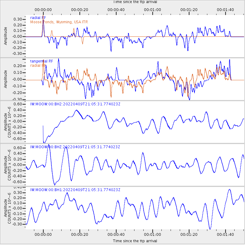
MOOW Moose Ponds, Wyoming, USA - Earthquake Result Viewer
*The percent match for this event was below the threshold and hence no stack was calculated.
| Earthquake location: |
Vanuatu Islands |
| Earthquake latitude/longitude: |
-16.3/166.8 |
| Earthquake time(UTC): |
2022/04/09 (099) 20:52:37 GMT |
| Earthquake Depth: |
10 km |
| Earthquake Magnitude: |
6.2 mww |
| Earthquake Catalog/Contributor: |
NEIC PDE/us |
|
| Network: |
IW Intermountain West |
| Station: |
MOOW Moose Ponds, Wyoming, USA |
| Lat/Lon: |
43.75 N/110.74 W |
| Elevation: |
2128 m |
|
| Distance: |
95.8 deg |
| Az: |
46.22 deg |
| Baz: |
253.068 deg |
| Ray Param: |
$rayparam |
*The percent match for this event was below the threshold and hence was not used in the summary stack. |
|
| Radial Match: |
30.41137 % |
| Radial Bump: |
400 |
| Transverse Match: |
57.31621 % |
| Transverse Bump: |
400 |
| SOD ConfigId: |
27527651 |
| Insert Time: |
2022-04-23 21:09:40.012 +0000 |
| GWidth: |
2.5 |
| Max Bumps: |
400 |
| Tol: |
0.001 |
|
Signal To Noise
| Channel | StoN | STA | LTA |
| IW:MOOW:00:BHZ:20220409T21:05:31.774023Z | 4.342245 | 3.6739021E-7 | 8.460836E-8 |
| IW:MOOW:00:BH1:20220409T21:05:31.774023Z | 0.63250804 | 9.093958E-8 | 1.4377615E-7 |
| IW:MOOW:00:BH2:20220409T21:05:31.774023Z | 0.75299037 | 2.4213506E-7 | 3.215646E-7 |
| Arrivals |
| Ps | |
| PpPs | |
| PsPs/PpSs | |


