You are here: Home > Network List > CN - Canadian National Seismograph Network Stations List
> Station INK INUVIK, NT > Earthquake Result Viewer
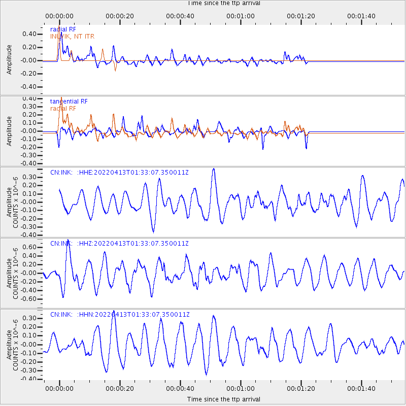
INK INUVIK, NT - Earthquake Result Viewer
*The percent match for this event was below the threshold and hence no stack was calculated.
| Earthquake location: |
Ryukyu Islands, Japan |
| Earthquake latitude/longitude: |
26.9/126.4 |
| Earthquake time(UTC): |
2022/04/13 (103) 01:22:33 GMT |
| Earthquake Depth: |
10 km |
| Earthquake Magnitude: |
5.7 Mww |
| Earthquake Catalog/Contributor: |
NEIC PDE/us |
|
| Network: |
CN Canadian National Seismograph Network |
| Station: |
INK INUVIK, NT |
| Lat/Lon: |
68.31 N/133.53 W |
| Elevation: |
44 m |
|
| Distance: |
68.9 deg |
| Az: |
23.1 deg |
| Baz: |
289.523 deg |
| Ray Param: |
$rayparam |
*The percent match for this event was below the threshold and hence was not used in the summary stack. |
|
| Radial Match: |
56.558468 % |
| Radial Bump: |
400 |
| Transverse Match: |
58.276386 % |
| Transverse Bump: |
340 |
| SOD ConfigId: |
27527651 |
| Insert Time: |
2022-04-27 01:34:40.746 +0000 |
| GWidth: |
2.5 |
| Max Bumps: |
400 |
| Tol: |
0.001 |
|
Signal To Noise
| Channel | StoN | STA | LTA |
| CN:INK: :HHZ:20220413T01:33:07.350011Z | 4.4593806 | 3.9857974E-7 | 8.9380066E-8 |
| CN:INK: :HHN:20220413T01:33:07.350011Z | 0.4103655 | 4.3096627E-8 | 1.050201E-7 |
| CN:INK: :HHE:20220413T01:33:07.350011Z | 1.9883269 | 2.0180816E-7 | 1.0149647E-7 |
| Arrivals |
| Ps | |
| PpPs | |
| PsPs/PpSs | |


