You are here: Home > Network List > GS - US Geological Survey Networks Stations List
> Station KAN13 Rinehart Farm > Earthquake Result Viewer
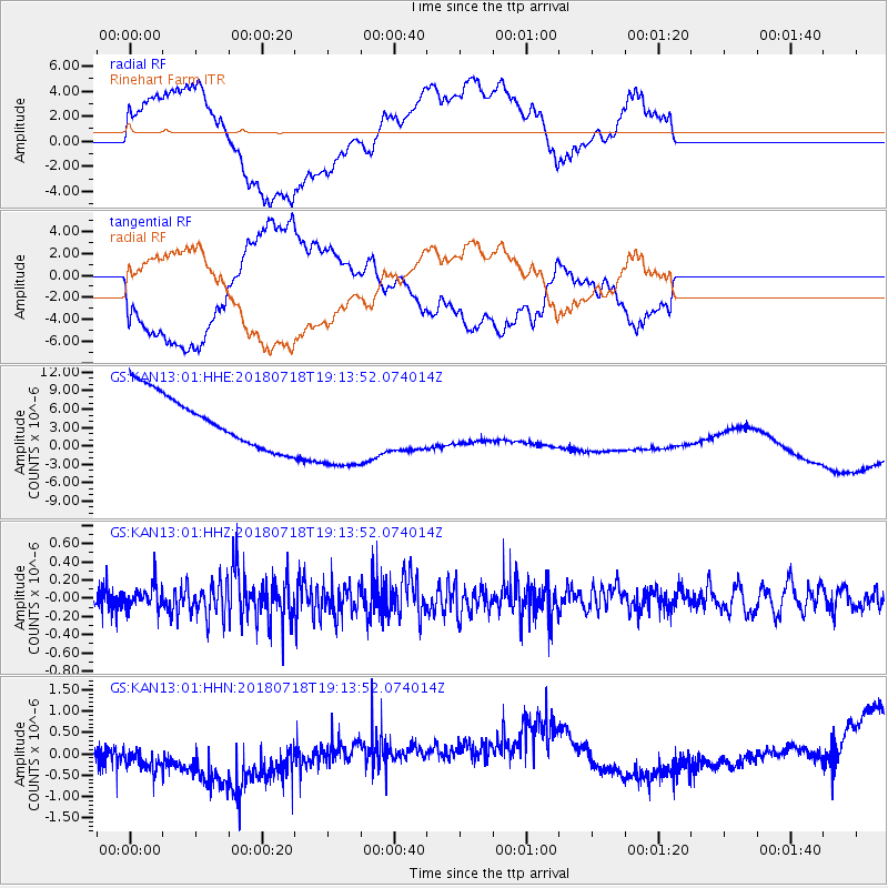
KAN13 Rinehart Farm - Earthquake Result Viewer
*The percent match for this event was below the threshold and hence no stack was calculated.
| Earthquake location: |
Alaska Peninsula |
| Earthquake latitude/longitude: |
54.4/-160.7 |
| Earthquake time(UTC): |
2018/07/18 (199) 19:06:03 GMT |
| Earthquake Depth: |
28 km |
| Earthquake Magnitude: |
5.6 Mww |
| Earthquake Catalog/Contributor: |
NEIC PDE/us |
|
| Network: |
GS US Geological Survey Networks |
| Station: |
KAN13 Rinehart Farm |
| Lat/Lon: |
37.01 N/97.48 W |
| Elevation: |
340 m |
|
| Distance: |
45.8 deg |
| Az: |
85.353 deg |
| Baz: |
313.275 deg |
| Ray Param: |
$rayparam |
*The percent match for this event was below the threshold and hence was not used in the summary stack. |
|
| Radial Match: |
28.744396 % |
| Radial Bump: |
400 |
| Transverse Match: |
22.819424 % |
| Transverse Bump: |
400 |
| SOD ConfigId: |
2768671 |
| Insert Time: |
2018-08-01 19:08:36.444 +0000 |
| GWidth: |
2.5 |
| Max Bumps: |
400 |
| Tol: |
0.001 |
|
Signal To Noise
| Channel | StoN | STA | LTA |
| GS:KAN13:01:HHZ:20180718T19:13:52.074014Z | 1.7925621 | 1.3267262E-7 | 7.4012846E-8 |
| GS:KAN13:01:HHN:20180718T19:13:52.074014Z | 1.2033249 | 1.1805587E-6 | 9.810806E-7 |
| GS:KAN13:01:HHE:20180718T19:13:52.074014Z | 1.6912373 | 7.202671E-6 | 4.258817E-6 |
| Arrivals |
| Ps | |
| PpPs | |
| PsPs/PpSs | |


