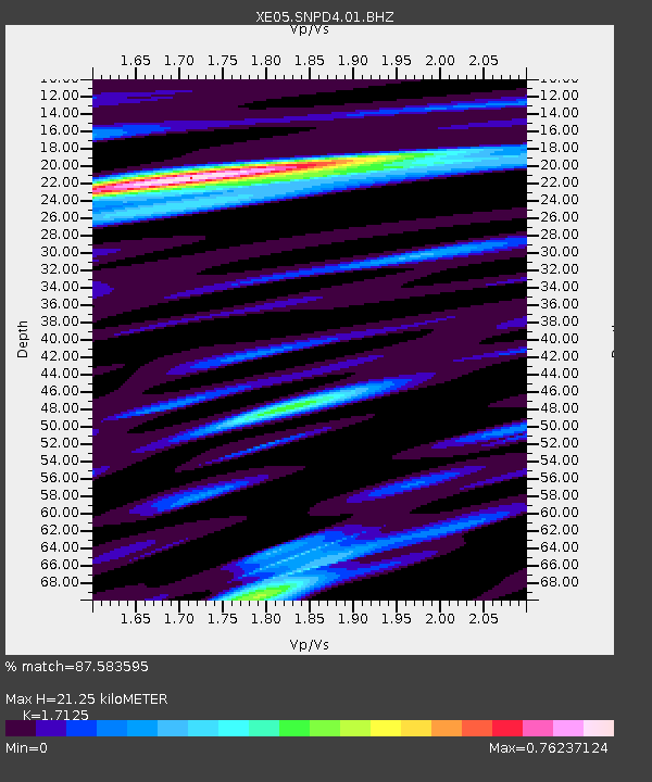
SNPD4 SNPD4 - Earthquake Result Viewer

Earthquake location: Mariana Islands
Earthquake latitude/longitude: 21.0/144.7
Earthquake time(UTC): 2007/01/30 (030) 21:37:45 GMT
Earthquake Depth: 30 km
Earthquake Magnitude: 6.3 MB, 6.5 MS, 6.6 MW, 6.5 MW
Earthquake Catalog/Contributor: WHDF/NEIC
Network: XE Sierra Nevada EarthScope Project- EarthScope Flex Array
Station: SNPD4 SNPD4
Lat/Lon: 39.04 N/121.17 W
Elevation: 402 m
Distance: 80.2 deg
Az: 52.033 deg
Baz: 288.923 deg
Ray Param: 0.048426464
Estimated Moho Depth: 21.25 km
Estimated Crust Vp/Vs: 1.71
Assumed Crust Vp: 6.597 km/s
Estimated Crust Vs: 3.853 km/s
Estimated Crust Poisson's Ratio: 0.24
Radial Match: 87.583595 %
Radial Bump: 400
Transverse Match: 90.45981 %
Transverse Bump: 400
SOD ConfigId: 268666
Insert Time: 2010-03-09 18:40:56.070 +0000
GWidth: 2.5
Max Bumps: 400
Tol: 0.001

Signal To Noise

ChannelStoNSTALTA
XE:SNPD4:01:BHZ:20070130T21:49:21.939009Z11.6655611.91184E-61.6388753E-7
XE:SNPD4:01:BHN:20070130T21:49:21.939009Z3.48743775.5475675E-71.5907287E-7
XE:SNPD4:01:BHE:20070130T21:49:21.939009Z3.60311417.639439E-72.1202322E-7
Arrivals
Ps2.4 SECOND
PpPs8.5 SECOND
PsPs/PpSs11 SECOND