You are here: Home > Network List > US - United States National Seismic Network Stations List
> Station HAWA Hanford, Washington, USA > Earthquake Result Viewer
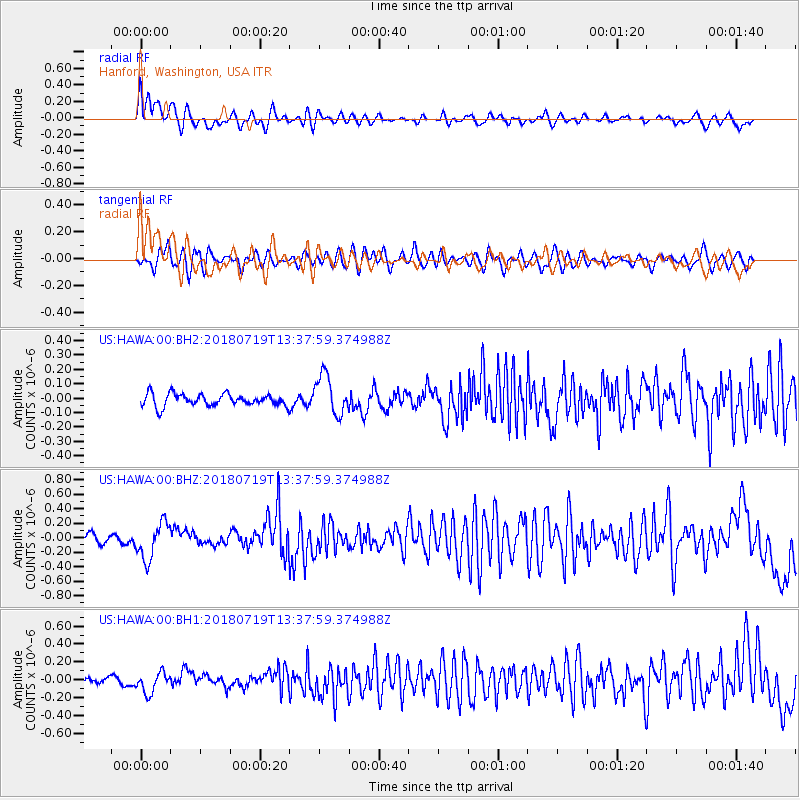
HAWA Hanford, Washington, USA - Earthquake Result Viewer
*The percent match for this event was below the threshold and hence no stack was calculated.
| Earthquake location: |
Oaxaca, Mexico |
| Earthquake latitude/longitude: |
17.8/-97.8 |
| Earthquake time(UTC): |
2018/07/19 (200) 13:31:53 GMT |
| Earthquake Depth: |
55 km |
| Earthquake Magnitude: |
5.7 Mww |
| Earthquake Catalog/Contributor: |
NEIC PDE/us |
|
| Network: |
US United States National Seismic Network |
| Station: |
HAWA Hanford, Washington, USA |
| Lat/Lon: |
46.39 N/119.53 W |
| Elevation: |
364 m |
|
| Distance: |
33.7 deg |
| Az: |
332.473 deg |
| Baz: |
140.496 deg |
| Ray Param: |
$rayparam |
*The percent match for this event was below the threshold and hence was not used in the summary stack. |
|
| Radial Match: |
77.60191 % |
| Radial Bump: |
400 |
| Transverse Match: |
61.682507 % |
| Transverse Bump: |
400 |
| SOD ConfigId: |
2778632 |
| Insert Time: |
2018-08-02 13:34:53.220 +0000 |
| GWidth: |
2.5 |
| Max Bumps: |
400 |
| Tol: |
0.001 |
|
Signal To Noise
| Channel | StoN | STA | LTA |
| US:HAWA:00:BHZ:20180719T13:37:59.374988Z | 2.760828 | 2.5152272E-7 | 9.11041E-8 |
| US:HAWA:00:BH1:20180719T13:37:59.374988Z | 2.2626963 | 1.1538538E-7 | 5.099464E-8 |
| US:HAWA:00:BH2:20180719T13:37:59.374988Z | 3.3056078 | 1.3801657E-7 | 4.1752255E-8 |
| Arrivals |
| Ps | |
| PpPs | |
| PsPs/PpSs | |


