You are here: Home > Network List > IW - Intermountain West Stations List
> Station MOOW Moose Ponds, Wyoming, USA > Earthquake Result Viewer
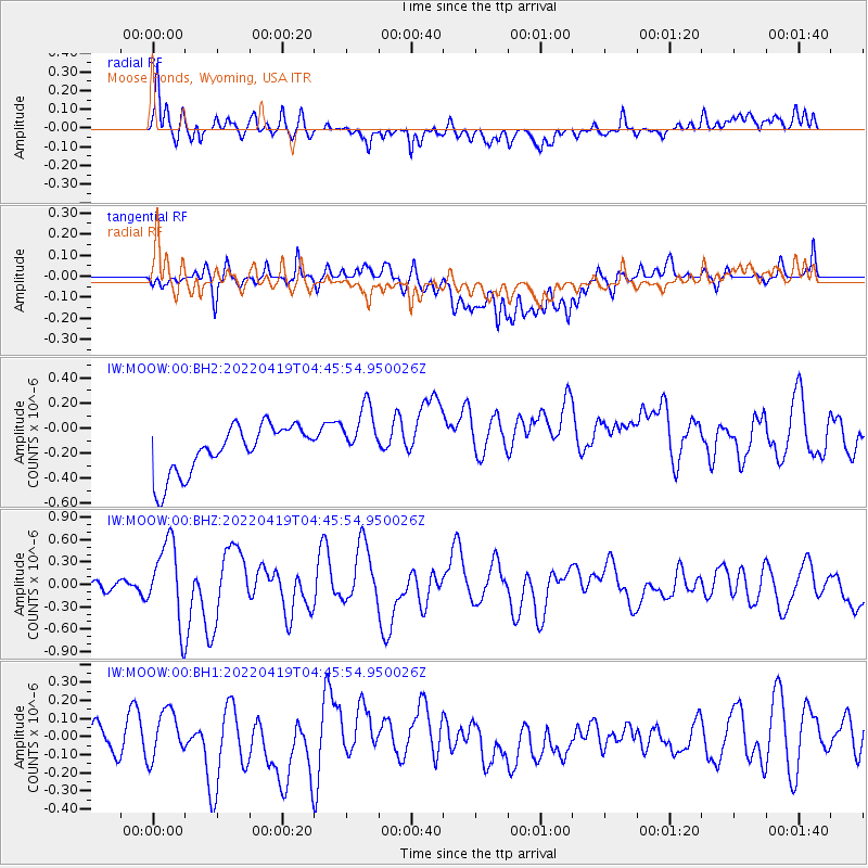
MOOW Moose Ponds, Wyoming, USA - Earthquake Result Viewer
*The percent match for this event was below the threshold and hence no stack was calculated.
| Earthquake location: |
Tonga Islands |
| Earthquake latitude/longitude: |
-21.5/-173.9 |
| Earthquake time(UTC): |
2022/04/19 (109) 04:33:41 GMT |
| Earthquake Depth: |
10 km |
| Earthquake Magnitude: |
6.0 mww |
| Earthquake Catalog/Contributor: |
NEIC PDE/us |
|
| Network: |
IW Intermountain West |
| Station: |
MOOW Moose Ponds, Wyoming, USA |
| Lat/Lon: |
43.75 N/110.74 W |
| Elevation: |
2128 m |
|
| Distance: |
86.9 deg |
| Az: |
40.363 deg |
| Baz: |
236.357 deg |
| Ray Param: |
$rayparam |
*The percent match for this event was below the threshold and hence was not used in the summary stack. |
|
| Radial Match: |
54.902016 % |
| Radial Bump: |
400 |
| Transverse Match: |
54.140015 % |
| Transverse Bump: |
400 |
| SOD ConfigId: |
27527651 |
| Insert Time: |
2022-05-03 04:52:56.213 +0000 |
| GWidth: |
2.5 |
| Max Bumps: |
400 |
| Tol: |
0.001 |
|
Signal To Noise
| Channel | StoN | STA | LTA |
| IW:MOOW:00:BHZ:20220419T04:45:54.950026Z | 4.957883 | 5.3371457E-7 | 1.0764969E-7 |
| IW:MOOW:00:BH1:20220419T04:45:54.950026Z | 0.94908977 | 1.4261715E-7 | 1.502673E-7 |
| IW:MOOW:00:BH2:20220419T04:45:54.950026Z | 1.2654545 | 2.42783E-7 | 1.9185438E-7 |
| Arrivals |
| Ps | |
| PpPs | |
| PsPs/PpSs | |


