You are here: Home > Network List > US - United States National Seismic Network Stations List
> Station AMTX Amarillo, Texas, USA > Earthquake Result Viewer
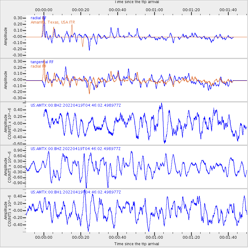
AMTX Amarillo, Texas, USA - Earthquake Result Viewer
*The percent match for this event was below the threshold and hence no stack was calculated.
| Earthquake location: |
Tonga Islands |
| Earthquake latitude/longitude: |
-21.5/-173.9 |
| Earthquake time(UTC): |
2022/04/19 (109) 04:33:41 GMT |
| Earthquake Depth: |
10 km |
| Earthquake Magnitude: |
6.0 mww |
| Earthquake Catalog/Contributor: |
NEIC PDE/us |
|
| Network: |
US United States National Seismic Network |
| Station: |
AMTX Amarillo, Texas, USA |
| Lat/Lon: |
34.53 N/101.41 W |
| Elevation: |
1010 m |
|
| Distance: |
88.5 deg |
| Az: |
51.97 deg |
| Baz: |
242.72 deg |
| Ray Param: |
$rayparam |
*The percent match for this event was below the threshold and hence was not used in the summary stack. |
|
| Radial Match: |
61.596493 % |
| Radial Bump: |
373 |
| Transverse Match: |
38.16915 % |
| Transverse Bump: |
400 |
| SOD ConfigId: |
27527651 |
| Insert Time: |
2022-05-03 05:02:39.383 +0000 |
| GWidth: |
2.5 |
| Max Bumps: |
400 |
| Tol: |
0.001 |
|
Signal To Noise
| Channel | StoN | STA | LTA |
| US:AMTX:00:BHZ:20220419T04:46:02.498977Z | 3.2507772 | 5.035103E-7 | 1.5488921E-7 |
| US:AMTX:00:BH1:20220419T04:46:02.498977Z | 1.2800981 | 2.3107128E-7 | 1.8051061E-7 |
| US:AMTX:00:BH2:20220419T04:46:02.498977Z | 0.65884405 | 1.3507686E-7 | 2.0502098E-7 |
| Arrivals |
| Ps | |
| PpPs | |
| PsPs/PpSs | |


