You are here: Home > Network List > UW - Pacific Northwest Regional Seismic Network Stations List
> Station UMAT Pilot Rock, OR, USA > Earthquake Result Viewer
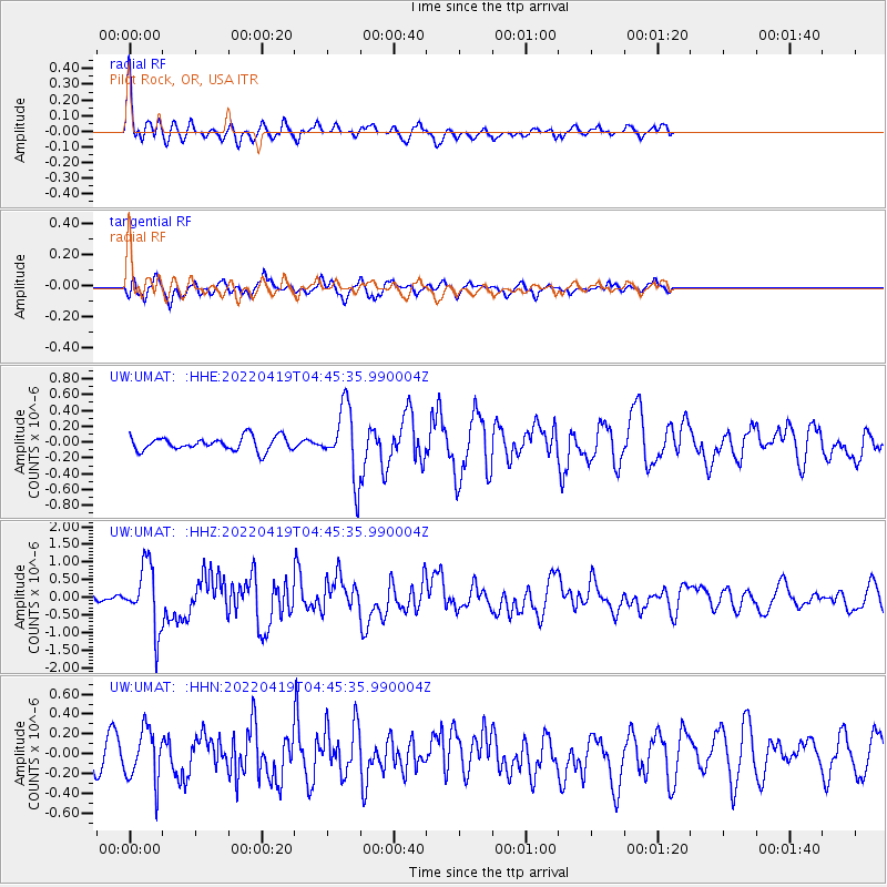
UMAT Pilot Rock, OR, USA - Earthquake Result Viewer
*The percent match for this event was below the threshold and hence no stack was calculated.
| Earthquake location: |
Tonga Islands |
| Earthquake latitude/longitude: |
-21.5/-173.9 |
| Earthquake time(UTC): |
2022/04/19 (109) 04:33:41 GMT |
| Earthquake Depth: |
10 km |
| Earthquake Magnitude: |
6.0 mww |
| Earthquake Catalog/Contributor: |
NEIC PDE/us |
|
| Network: |
UW Pacific Northwest Regional Seismic Network |
| Station: |
UMAT Pilot Rock, OR, USA |
| Lat/Lon: |
45.29 N/118.96 W |
| Elevation: |
1318 m |
|
| Distance: |
83.1 deg |
| Az: |
35.601 deg |
| Baz: |
230.195 deg |
| Ray Param: |
$rayparam |
*The percent match for this event was below the threshold and hence was not used in the summary stack. |
|
| Radial Match: |
78.78293 % |
| Radial Bump: |
396 |
| Transverse Match: |
40.108006 % |
| Transverse Bump: |
340 |
| SOD ConfigId: |
27527651 |
| Insert Time: |
2022-05-03 05:05:31.787 +0000 |
| GWidth: |
2.5 |
| Max Bumps: |
400 |
| Tol: |
0.001 |
|
Signal To Noise
| Channel | StoN | STA | LTA |
| UW:UMAT: :HHZ:20220419T04:45:35.990004Z | 13.95364 | 8.9442324E-7 | 6.409964E-8 |
| UW:UMAT: :HHN:20220419T04:45:35.990004Z | 1.9751247 | 2.587171E-7 | 1.3098773E-7 |
| UW:UMAT: :HHE:20220419T04:45:35.990004Z | 5.0416684 | 4.3519086E-7 | 8.631882E-8 |
| Arrivals |
| Ps | |
| PpPs | |
| PsPs/PpSs | |


