You are here: Home > Network List > UW - Pacific Northwest Regional Seismic Network Stations List
> Station IRON Crane, OR, USA > Earthquake Result Viewer
IRON Crane, OR, USA - Earthquake Result Viewer
*The percent match for this event was below the threshold and hence no stack was calculated.
| Earthquake location: |
Southeast Of Loyalty Islands |
| Earthquake latitude/longitude: |
-22.8/170.9 |
| Earthquake time(UTC): |
2022/04/20 (110) 05:13:07 GMT |
| Earthquake Depth: |
10 km |
| Earthquake Magnitude: |
5.7 Mww |
| Earthquake Catalog/Contributor: |
NEIC PDE/us |
|
| Network: |
UW Pacific Northwest Regional Seismic Network |
| Station: |
IRON Crane, OR, USA |
| Lat/Lon: |
43.36 N/118.47 W |
| Elevation: |
1226 m |
|
| Distance: |
92.4 deg |
| Az: |
43.535 deg |
| Baz: |
240.598 deg |
| Ray Param: |
$rayparam |
*The percent match for this event was below the threshold and hence was not used in the summary stack. |
|
| Radial Match: |
55.826084 % |
| Radial Bump: |
357 |
| Transverse Match: |
65.34602 % |
| Transverse Bump: |
400 |
| SOD ConfigId: |
27527651 |
| Insert Time: |
2022-05-04 05:29:59.966 +0000 |
| GWidth: |
2.5 |
| Max Bumps: |
400 |
| Tol: |
0.001 |
|
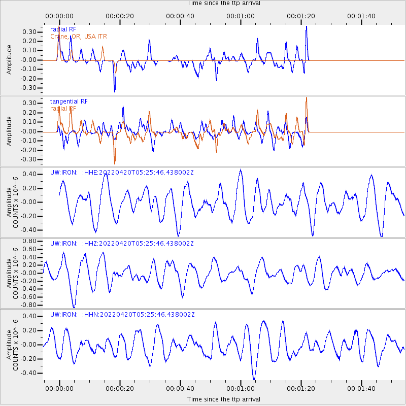
Signal To Noise
| Channel | StoN | STA | LTA |
| UW:IRON: :HHZ:20220420T05:25:46.438002Z | 2.2388058 | 3.8730957E-7 | 1.7299828E-7 |
| UW:IRON: :HHN:20220420T05:25:46.438002Z | 1.3098973 | 1.6491128E-7 | 1.2589635E-7 |
| UW:IRON: :HHE:20220420T05:25:46.438002Z | 0.8089345 | 1.6582918E-7 | 2.0499705E-7 |
| Arrivals |
| Ps | |
| PpPs | |
| PsPs/PpSs | |


