You are here: Home > Network List > US - United States National Seismic Network Stations List
> Station AMTX Amarillo, Texas, USA > Earthquake Result Viewer
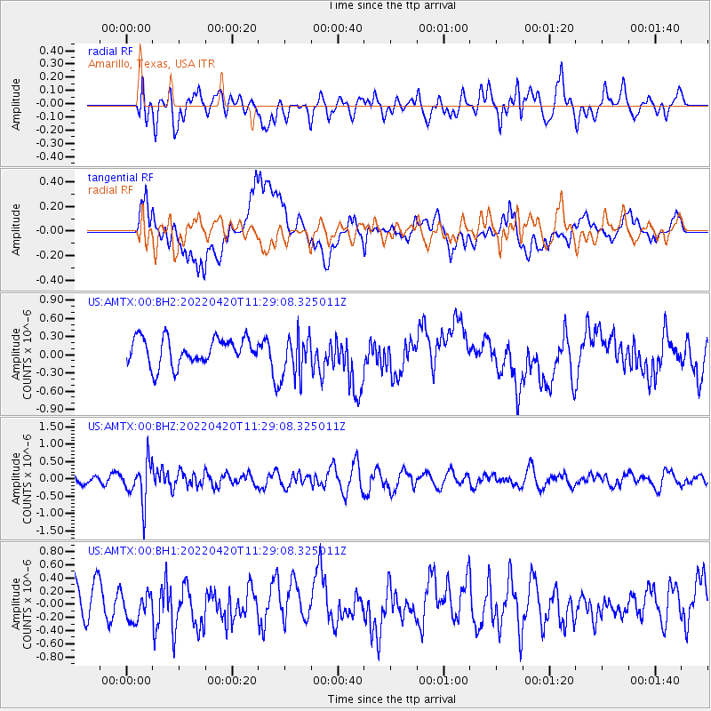
AMTX Amarillo, Texas, USA - Earthquake Result Viewer
*The percent match for this event was below the threshold and hence no stack was calculated.
| Earthquake location: |
Northern Chile |
| Earthquake latitude/longitude: |
-22.9/-68.2 |
| Earthquake time(UTC): |
2022/04/20 (110) 11:19:04 GMT |
| Earthquake Depth: |
97 km |
| Earthquake Magnitude: |
5.7 mww |
| Earthquake Catalog/Contributor: |
NEIC PDE/us |
|
| Network: |
US United States National Seismic Network |
| Station: |
AMTX Amarillo, Texas, USA |
| Lat/Lon: |
34.53 N/101.41 W |
| Elevation: |
1010 m |
|
| Distance: |
65.3 deg |
| Az: |
330.152 deg |
| Baz: |
146.238 deg |
| Ray Param: |
$rayparam |
*The percent match for this event was below the threshold and hence was not used in the summary stack. |
|
| Radial Match: |
45.274788 % |
| Radial Bump: |
400 |
| Transverse Match: |
44.043957 % |
| Transverse Bump: |
400 |
| SOD ConfigId: |
27527651 |
| Insert Time: |
2022-05-04 11:47:52.316 +0000 |
| GWidth: |
2.5 |
| Max Bumps: |
400 |
| Tol: |
0.001 |
|
Signal To Noise
| Channel | StoN | STA | LTA |
| US:AMTX:00:BHZ:20220420T11:29:08.325011Z | 2.596806 | 5.698769E-7 | 2.19453E-7 |
| US:AMTX:00:BH1:20220420T11:29:08.325011Z | 0.68481606 | 2.2827017E-7 | 3.3333063E-7 |
| US:AMTX:00:BH2:20220420T11:29:08.325011Z | 1.72069 | 3.85526E-7 | 2.2405314E-7 |
| Arrivals |
| Ps | |
| PpPs | |
| PsPs/PpSs | |


