You are here: Home > Network List > US - United States National Seismic Network Stations List
> Station MSO Missoula, Montana, USA > Earthquake Result Viewer
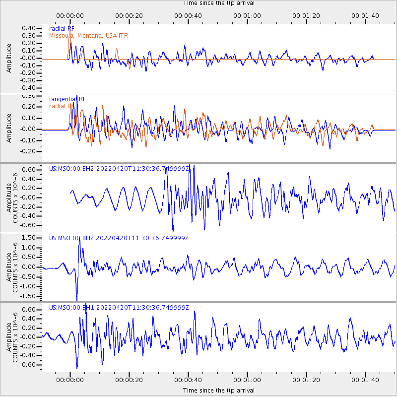
MSO Missoula, Montana, USA - Earthquake Result Viewer
*The percent match for this event was below the threshold and hence no stack was calculated.
| Earthquake location: |
Northern Chile |
| Earthquake latitude/longitude: |
-22.9/-68.2 |
| Earthquake time(UTC): |
2022/04/20 (110) 11:19:04 GMT |
| Earthquake Depth: |
97 km |
| Earthquake Magnitude: |
5.7 mww |
| Earthquake Catalog/Contributor: |
NEIC PDE/us |
|
| Network: |
US United States National Seismic Network |
| Station: |
MSO Missoula, Montana, USA |
| Lat/Lon: |
46.83 N/113.94 W |
| Elevation: |
1264 m |
|
| Distance: |
80.8 deg |
| Az: |
330.124 deg |
| Baz: |
138.027 deg |
| Ray Param: |
$rayparam |
*The percent match for this event was below the threshold and hence was not used in the summary stack. |
|
| Radial Match: |
46.9633 % |
| Radial Bump: |
400 |
| Transverse Match: |
59.512863 % |
| Transverse Bump: |
400 |
| SOD ConfigId: |
27527651 |
| Insert Time: |
2022-05-04 11:48:40.718 +0000 |
| GWidth: |
2.5 |
| Max Bumps: |
400 |
| Tol: |
0.001 |
|
Signal To Noise
| Channel | StoN | STA | LTA |
| US:MSO:00:BHZ:20220420T11:30:36.749999Z | 7.3645735 | 7.300766E-7 | 9.913359E-8 |
| US:MSO:00:BH1:20220420T11:30:36.749999Z | 2.4609053 | 2.608764E-7 | 1.060083E-7 |
| US:MSO:00:BH2:20220420T11:30:36.749999Z | 2.4470994 | 3.297941E-7 | 1.347694E-7 |
| Arrivals |
| Ps | |
| PpPs | |
| PsPs/PpSs | |


