You are here: Home > Network List > US - United States National Seismic Network Stations List
> Station WMOK Wichita Mountains, Oklahoma, USA > Earthquake Result Viewer
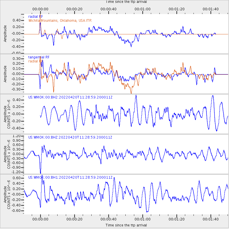
WMOK Wichita Mountains, Oklahoma, USA - Earthquake Result Viewer
*The percent match for this event was below the threshold and hence no stack was calculated.
| Earthquake location: |
Northern Chile |
| Earthquake latitude/longitude: |
-22.9/-68.2 |
| Earthquake time(UTC): |
2022/04/20 (110) 11:19:04 GMT |
| Earthquake Depth: |
97 km |
| Earthquake Magnitude: |
5.7 mww |
| Earthquake Catalog/Contributor: |
NEIC PDE/us |
|
| Network: |
US United States National Seismic Network |
| Station: |
WMOK Wichita Mountains, Oklahoma, USA |
| Lat/Lon: |
34.74 N/98.78 W |
| Elevation: |
486 m |
|
| Distance: |
64.3 deg |
| Az: |
332.293 deg |
| Baz: |
148.638 deg |
| Ray Param: |
$rayparam |
*The percent match for this event was below the threshold and hence was not used in the summary stack. |
|
| Radial Match: |
45.794636 % |
| Radial Bump: |
400 |
| Transverse Match: |
50.298676 % |
| Transverse Bump: |
400 |
| SOD ConfigId: |
27527651 |
| Insert Time: |
2022-05-04 11:48:59.972 +0000 |
| GWidth: |
2.5 |
| Max Bumps: |
400 |
| Tol: |
0.001 |
|
Signal To Noise
| Channel | StoN | STA | LTA |
| US:WMOK:00:BHZ:20220420T11:28:59.200011Z | 3.128412 | 4.802175E-7 | 1.53502E-7 |
| US:WMOK:00:BH1:20220420T11:28:59.200011Z | 2.8128688 | 3.432892E-7 | 1.2204238E-7 |
| US:WMOK:00:BH2:20220420T11:28:59.200011Z | 0.64095014 | 1.2175494E-7 | 1.8996006E-7 |
| Arrivals |
| Ps | |
| PpPs | |
| PsPs/PpSs | |


